
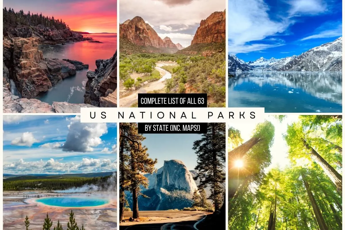
Explore the natural wonders of America with our comprehensive list of National Parks by State in the USA which includes maps, tips, must-see highlights for each park, and a free printable national park checklist.
The United States is home to 63 national parks, each one offering unique natural beauty and recreational opportunities, from rugged wilderness and towering peaks to sparkling lakes and gentle meadows.
The National Park Service (NPS) was established in 1916 by President Woodrow Wilson to protect and preserve these natural and historical treasures for the enjoyment of future generations. The NPS is responsible for the management of these parks, which cover more than 84 million acres of land across the country.
The parks offer a wide variety of activities, such as hiking, camping, fishing, and wildlife watching, as well as ranger-led programs and educational opportunities and are a great place to spend time with family and friends, and create memories that will last a lifetime.
They are an important part of America’s heritage, and visiting them is an opportunity to understand and appreciate the natural and cultural resources that make this country unique. Everyone should visit at least one of these national parks, but with 63 to choose from, scattered to all corners of the country, which one should you visit first?! This post will hopefully help you decide and give you some top tips for planning your visit.

 Disclaimer: Almost all posts on this site contain affiliate links, and this one containing a Complete List of National Parks By State in the USA is no different. This means that if you click on any of the links in this post (and make a purchase) I may receive a small commission at absolutely no cost to you. Each post is carefully crafted to (hopefully!) answer all your questions and recommendations are made where we believe they will improve your trip and help with your planning. As such we thank you in advance should you decide to click & buy. Read my full Disclosure here.
In This Post
- 1 Tips for Planning a Visit to a National Park
- 2 Frequently Asked Questions about the 63 United States National Parks
- 3 Interactive Map of all 63 US National Parks
- 4 Complete List of National Parks by State (inc. Maps, Pics & Information About Each)
- 5 Free Printable Checklist of National Parks Listed by State
- 6 Useful US National Parks Lists (By State – Summary, In Alphabetical Order, By Most Visited, By Least Visited)
Tips for Planning a Visit to a National Park

- Research the park you plan to visit: Each national park is unique and offers different activities and facilities, so it’s important to research the park ahead of time to make the most of your visit. This includes opening and closing times, and any seasonal changes.
- Check the park’s calendar of events: Many national parks offer ranger-led programs, guided tours, special events and scheduled closures throughout the year, so check the park’s calendar to see what’s happening during your visit.
- Avoid the crowds by visiting in the off-season or shoulder seasons: The Parks can get exceedingly busy during the summer months, so if at all possible, avoid peak summer and visit in the off-season or shoulder seasons.
- Check the weather and pack accordingly: Weather conditions can vary greatly within a park, and temperatures can change quickly, especially in the mountains, so be sure to check the forecast and pack accordingly.
- Make a reservation: Some national parks have a limited number of campsites and lodging options, so it’s a good idea to make a reservation ahead of time to ensure you have a place to stay.
- Be prepared for wildlife encounters: Many national parks are home to a variety of wildlife, so be prepared for encounters and always follow park rules and regulations for viewing and interacting with wildlife.
- Bring plenty of water and snacks: Many national parks are in remote areas and facilities may be limited, so be sure to bring enough water and snacks to last the day.
- Be respectful of the park: Remember to leave no trace, respect the park’s rules and regulations, and be mindful of other visitors’ experiences. Read our Essential Hiking Tips for more like this; and
- Check trail status before hiking: Be sure to check in at the Park information center or ranger station for on-the-day trail status before starting any hike.
- Get a National Parks Pass and National Park Passport: if you plan to visit several national parks, you can purchase an annual pass, which will save you money and allow you to enter all the national parks without additional fees. And a National Park Passport can help you keep track of everywhere you have been – and where you are visiting next!
Frequently Asked Questions about the 63 United States National Parks

What is a National Park, a National Preserve, and a National Monument?
- A National Park is an area of land designated by the federal government for the preservation of natural, cultural, or historical resources for the enjoyment of future generations. National Parks are generally large and offer a wide range of recreational activities such as hiking, camping, and wildlife viewing. They are managed by the National Park Service.
- A National Preserve is a type of protected area designated by the federal government for the preservation of natural resources, such as wildlife and their habitats. National preserves are similar to national parks, but they may allow hunting and other activities that are not typically allowed in national parks. They are also managed by the National Park Service.
- A National Monument is a protected area designated by the federal government to preserve one or more specific cultural, historical, or natural features. National Monuments can be created by the President of the United States or by act of Congress, and they are managed by various federal agencies, including the National Park Service, the Bureau of Land Management, and the U.S. Forest Service.
How many National Parks are there in the United States?
As of 2024, there are 63 national parks across 30 States.
How many States don’t have a National Park?
There are 20 States without a National Park (plus the District of Columbia)
– If you can afford to travel, you can afford – and should definitely buy – Travel Insurance
– For Car Rental (anywhere in the world!) we recommend Discover Cars
Which States do not have National Parks?
The states with no national parks are Alabama, Connecticut, Delaware, Georgia, Iowa, Kansas, Louisiana, Maryland, Massachusetts, Mississippi, Nebraska, New Hampshire, New Jersey, New York, Oklahoma, Pennsylvania, Rhode Island, Vermont, and Wisconsin.
Which State has the most National Parks?
California has the most with 9 national parks, with Alaska coming in a close second with 8.

Which US National Park is the most visited?
With over 14.1 million visitors per year, Great Smoky Mountains National Park is the most visited national park in the United States.
What is the Least Visited National Park in the USA?
Welcoming only 9,457 visitors (in 2022), Gates of the Arctic National Park in Alaska is the least visited national park in the USA.
Which is the Largest National Park in the USA?
The largest national park in the United States is Wrangell-St. Elias National Park and Preserve, located in Alaska. It covers an area of 13.2 million acres, making it the largest national park in the United States and also one of the largest in the world.
Which is the Smallest National Park in the USA?
Gateway Arch National Park, located in St. Louis, Missouri, is the smallest national park in the United States, covering only 91 acres.

What are National Park System Units?
In addition to the 63 US National Parks, the National Parks Service are also responsible for 360 National Park System Units. (Combined to bring the total number of National Park System Units to 423) These 360 National Park System Units are of national significance. (Click here for a breakdown of all the designations below)
They can be found in all 50 states and include:
- 16 National Battlefields, Battlefield Parks & Battlefield Sites
- 9 National Military Parks
- 137 National Historical Parks & National Historic Sites
- 27 National Lakeshores, National Seashores National Rivers & National Wild and Scenic Rivers and Riverways
- 31 National Memorials
- 85 National Monuments
- 4 National Parkways
- 39 National Preserves, National Reserves & National Recreation Areas
- 3 National Scenic Trails; plus
- 11 Other Delegations
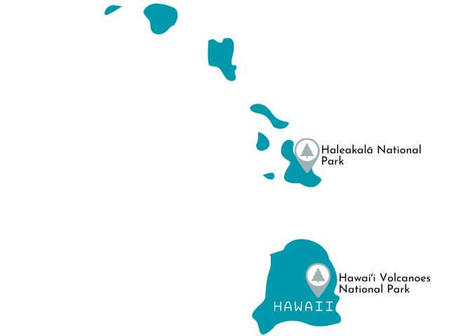
Interactive Map of all 63 US National Parks
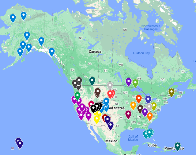
 This map of the 63 United States National Parks, is color-coded by state. Click the map itself or here to open it in another window where you can zoom in and out between parks.
Complete List of National Parks by State (inc. Maps, Pics & Information About Each)
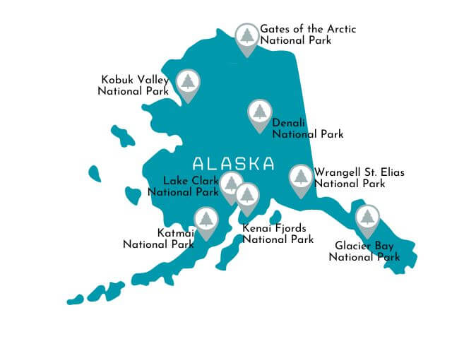
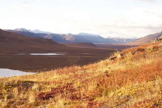
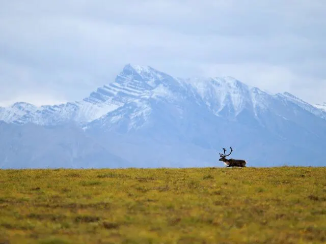
National Parks in Alaska

Denali National Park

 Year Established: 1917
Size: 6+ million acres
Annual Visitors: Around 600,000
Best Time to Visit: June to August
Denali National Park Highlights: See Mount Denali (fka Mount McKinley), Spot the Denali Big 5 on a Flightseeing Tour, Hike the Savage River area and Mount Healy Overlook.
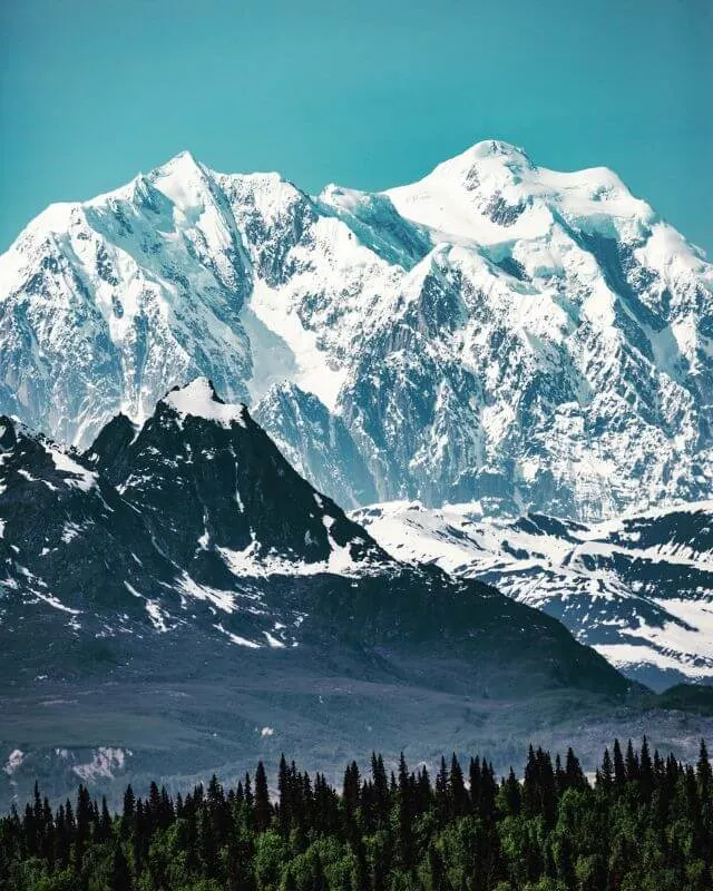
Denali National Park is a vast wilderness area located in the interior of Alaska. It is home to the highest peak in North America, Denali (formerly known as Mount McKinley), which stands at 20,310 feet tall. The park offers a wide variety of outdoor recreational activities, such as hiking, camping, and wildlife viewing. Visitors can see grizzly bears, wolves, caribou, moose, Dall sheep, and many species of birds. The park’s history goes back to the Koyukon Athabascans, who have lived in the area for thousands of years, and the park is rich in cultural history.
One of the highlights of visiting Denali National Park is taking a bus tour in to the park’s interior. The tour provides access to remote areas of the park and offers opportunities to see wildlife and take in the park’s stunning scenery. Hiking is another popular activity, with a variety of trails that range in difficulty and offer different experiences, such as the challenging climb to the summit of Denali or the more leisurely hike to a nearby ridge for stunning views of the park.
When visiting the park, it’s important to be prepared for the harsh weather conditions and bring appropriate clothing and gear. It’s also important to be aware of the park’s regulations, such as bear safety guidelines, and to follow park rules and guidelines to protect the wilderness and preserve the park for future generations.
Gates of the Arctic National Park

 Year Established: 1980
Size: 259,000 acres
Annual Visitors: Around 10,000
Best Time to Visit: June to July
Gates of the Arctic NP Highlights: See the Gates of the Arctic, paddle along the park’s rivers, take a flightseeing tour, and enjoy the untouched, remote, pristine wilderness.
Gates of the Arctic National Park is a remote wilderness area located in the northernmost part of Alaska and is entirely within the Arctic circle! It is the second-largest national park in the United States, covering over 8 million acres of rugged mountains, wild rivers, and tundra. The park is home to a variety of wildlife, including caribou, grizzly bears, wolves, and wolverines, and is also a popular destination for backcountry hiking, camping, and fishing.
The park is named after the Brooks Range mountains which are often referred to as the “Gates of the Arctic” and it is one of the wildest and least visited national parks in the country. The park offers little in terms of infrastructure and visitors should be prepared for a true wilderness experience. It’s a place where one can find solitude and silence, and a chance to immerse in nature.
Visiting the Gates of the Arctic National Park requires a high level of self-sufficiency, as the park has no roads or marked trails and no facilities or services. Visitors should be well-prepared with appropriate clothing, gear, and supplies, and they should have experience with wilderness travel and navigation.
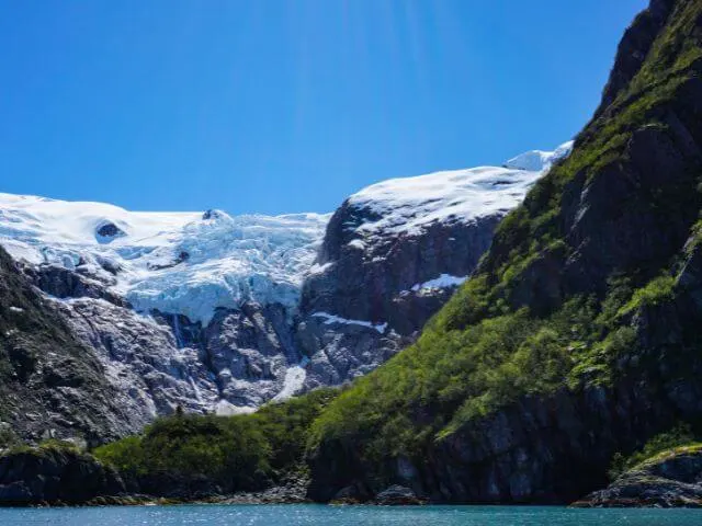
Glacier Bay National Park

 Year Established: 1980
Size: 3.3 million acres
Annual Visitors: 670,000
Best Time to Visit: June to September
Glacier Bay National Park Highlights: The Glacier Bay Lodge boat tour, see glaciers, Hike Bartlett Cove, Kayak Muir Inlet
Glacier Bay National Park and Preserve is a stunning wilderness area located in the southern part of Alaska. The park is known for its glaciers, fjords, and snow-capped mountains, as well as its abundant wildlife and marine life. Visitors can see whales, seals, otters, and many species of birds, and there are also opportunities for kayaking, sailing, and fishing.
The park’s history is closely tied to the glaciers that formed the bay over thousands of years. The park was established in 1925 as a national monument and later became a national park and preserve in 1980. Today, Glacier Bay is one of the most popular tourist destinations in Alaska, and it’s a UNESCO World Heritage Site.
One of the highlights of visiting Glacier Bay National Park is taking a boat tour to see the glaciers and wildlife. Visitors can also hike on the park’s trails and explore the backcountry, but it’s important to be prepared for the rugged terrain, and unpredictable weather, have adequate bear safety precautions in place, and follow boating regulations.
Visitors should also be aware that the park has limited facilities and services, so visitors should plan accordingly and bring enough food, water, and other supplies.
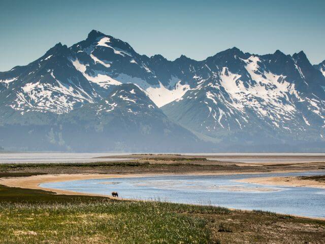
Katmai National Park

 Year Established: 1980
Size: 4 million acres
Annual Visitors: 84,000
Best Time to Visit: June to September
Katmai National Park Highlights: See brown bears at Brooks Falls, Visit Naknek Lake, Backpack Valley of Ten Thousand Smokes and take a flightseeing tour.
Katmai National Park and Preserve is a wilderness area located in southern Alaska, known for its rugged mountains, glaciers, and vast expanses of wilderness. The park is home to one of the largest protected brown bear populations in the world and it’s a popular destination for bear watching and wildlife viewing. The park is also home to the Valley of Ten Thousand Smokes, a volcanic ash-filled valley that was formed by the eruption of Novarupta in 1912.
The park’s history goes back to the early 20th century when it was created as a national monument to protect the Valley of Ten Thousand Smokes. In 1980, it was designated as a national park and preserve. Today, Katmai National Park is a popular destination for outdoor enthusiasts and wildlife watchers, and it’s a UNESCO World Heritage Site.
One of the highlights of visiting Katmai National Park is the opportunity to see the brown bears that congregate along the Brooks River to catch spawning salmon. Visitors can also hike on the park’s trails and explore the backcountry, but it’s important to be prepared for the rugged terrain and unpredictable weather.
Kenai Fjords National Park

 Year Established: 1980
Size: 600,000 acres
Annual Visitors: 350,000
Best Time to Visit: June to August
Kenai Fjords National Park Highlights: Hike Harding Icefield, Take a Wildlife Cruise, Drive Exit Glacier Road, Ice Climb on Exit Glacier.
Kenai Fjords National Park is located in southern Alaska, known for its rugged fjords, glaciers, and abundant marine life. The park is home to several glaciers including the Exit Glacier, which visitors can hike to, and the Harding Icefield, which is one of the largest icefields in the United States. The park is also home to many species of wildlife such as sea otters, sea lions, and various species of whales and birds.
The park’s history dates back to 1980 when it was created as a national park to protect the area’s natural beauty and wildlife. Today, Kenai Fjords National Park is a popular destination for outdoor enthusiasts and wildlife watchers.
One of the highlights of visiting Kenai Fjords National Park is taking a boat tour to see the glaciers and wildlife. Visitors can also hike on the park’s trails and explore the backcountry, but it’s important to be prepared for the rugged terrain and unpredictable weather.
As with almost all the other National Parks in Alaska and due to their remote nature, visitors should also be aware that the park has limited facilities and services and so should plan accordingly, i.e. bring enough food, water, and other supplies.
Kobuk Valley National Park

 Year Established: 1980
Size: 1.75 million acres
Annual Visitors: 16,000
Best Time to Visit: June to September
Kobuk Valley National Park Highlights: GoWildlife Watching, See the Kobuk Sand Dunes, Take a flightseeing tour
Kobuk Valley National Park is located in northern Alaska, known for its vast wilderness, sand dunes, and caribou migration. The park is home to the Kobuk River, one of the largest undammed rivers in the United States, and the Great Kobuk Sand Dunes, which are the largest dunes in the Arctic. The park is also home to a variety of wildlife, including grizzly bears, wolves, wolverines, and many species of birds.
The native people of the area have lived in the Kobuk Valley for thousands of years, and the park is also home to the traditional hunting grounds of the Inupiat people. Today, Kobuk Valley National Park is a popular destination for outdoor enthusiasts and wildlife watchers.
One of the highlights of visiting Kobuk Valley National Park is the opportunity to see the caribou migration, which is one of the largest in the world. Visitors can also hike on the park’s trails and explore the backcountry, but it’s important to be prepared for the rugged terrain and unpredictable weather. Again, facilities within the park are limited.
Lake Clark National Park
 Year Established: 1980
Size: 4 million acres
Annual Visitors: 17,000
Best Time to Visit: June to September
Lake Clark National Park Highlights: Spot Wildlife, Go fishing, Hike Tanalian Falls, Backpack Telaquana Trail, Canoe Lake Clark.
Lake Clark National Park is located in southwestern Alaska and encompasses over 4 million acres of wilderness, including the Chigmit Mountains, the Kvichak River, and the lake for which it is named. The park is home to a wide variety of wildlife, including brown bears, moose, wolves, and many species of birds. The park is also home to several active volcanoes, including the Redoubt volcano.
The park’s history dates back to 1978, when it was created as a national park to protect the area’s natural beauty and wildlife. Today, Lake Clark National Park is a popular destination for outdoor enthusiasts and wildlife watchers. Visitors can explore the park’s wilderness by hiking, fishing, and rafting. The park also has several opportunities for wildlife viewing, including bear viewing and bird watching.
The best time to visit Lake Clark National Park is in the summer months, when the weather is warmer and the days are longer. This is also the best time to see the park’s wildlife, as many animals are more active during this time of year. Visitors should be prepared for the rugged terrain and unpredictable weather, and with limited facilities, visitors should bring enough food, water, and other supplies.
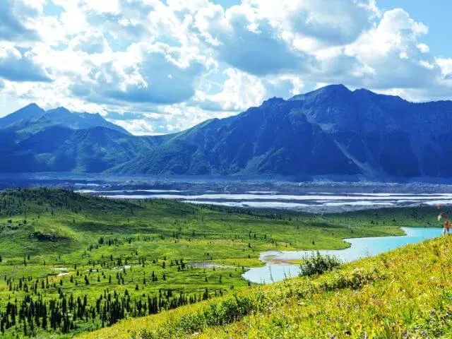
Wrangell-St. Elias National Park

 Year Established: 1980
Size: 13 million acres
Annual Visitors: 75,000
Best Time to Visit: June to September
Wrangell-St. Elias National Park Highlights: Take a flightseeing Tour, See Kennecott Copper Mine, Drive McCarthy Road, and visit the Kennecott Mines National Historic Landmark.
Wrangell-St. Elias National Park is located in the southeastern part of Alaska and is the largest national park in the United States, covering over 13 million acres of wilderness. The park is home to several mountain ranges, glaciers, rivers, and lakes. The park is also home to an abundance of wildlife, including bears, wolves, moose, and caribou. The park also has a rich cultural history, with the area being home to the Ahtna people for thousands of years.
The park is a popular destination for outdoor enthusiasts and adventure seekers, with opportunities for hiking, camping, fishing, and backpacking. Visitors can also take scenic flights or guided tours to explore the park’s glaciers and mountain ranges. The park also has several historic sites and buildings, including the Kennecott Mines National Historic Landmark, a former copper mining town from the early 20th century.
The best time to visit Wrangell-St. Elias National Park is during the summer months, when the weather is warmer and the days are longer, and also when visitors have the best chance of viewing the wildlife.
+ 11 National Park Service Units in Alaska
- Alagnak Wild River
- Alaska Public Lands
- Aleutian Islands WWII National Monument
- Aniakchak National Monument & Preserve
- Bering Land Bridge National Preserve
- Cape Krusenstern National Monument
- Iñupiat Heritage Center
- Klondike Gold Rush National Historical Park
- Noatak National Preserve
- Sitka National Historical Park
- Yukon-Charley Rivers National Preserve
National Parks in American Samoa
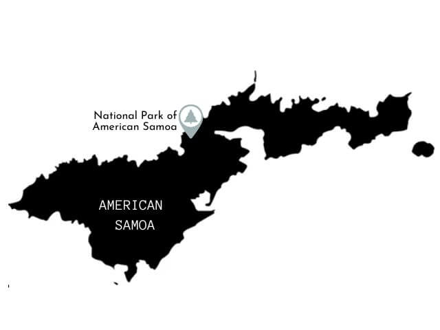

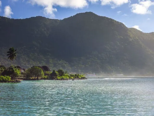
National Park of American Samoa

 Year Established: 1988
Size: 13,500 acres (9,500 acres of land, 4,000 marine acres)
Annual Visitors: 60,000
Best Time to Visit: June to September
American Samoa National Park Highlights: Take a boat trip around the islands, Hike the Mount’Alava Trail, Snorkel Vatia Bay and Ofu Beach
The National Park of American Samoa is located in the South Pacific Ocean and is the only national park in the United States that is located south of the equator. The park is made up of three of the islands in the Samoan archipelago, Tutuila, Ofu, and Ta’u, and covers over 13,500 acres of land and water. The park is home to a diverse array of plants and animals, including over 900 species of fish, over 200 species of coral, and several species of birds, bats, and insects that are found nowhere else in the world.
The park is popular with visitors who are interested in hiking, snorkeling, and diving. Visitors can hike through lush rainforests, swim in crystal-clear waters, and explore the park’s coral reefs. The park also has several cultural sites, including ancient village sites and the National Park of American Samoa Visitors Center, which provides information about the park’s natural and cultural resources.
The best time to visit the National Park of American Samoa is from April to October, when the weather is drier and cooler. During this time of year, visitors can expect mild temperatures, low humidity, and less rainfall. Visitors should also be aware that the park is closed on Sundays and that permits are required for certain activities, such as camping and hiking.
National Parks in Arizona
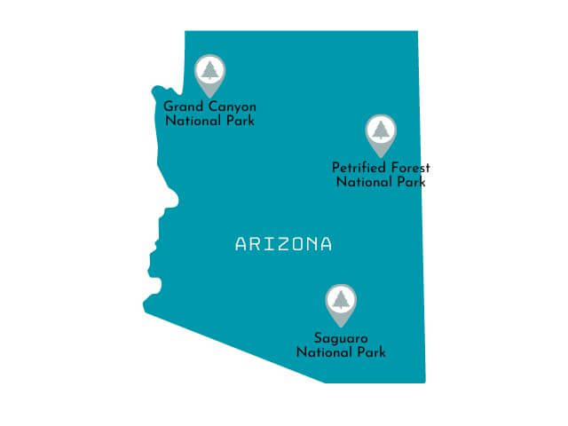

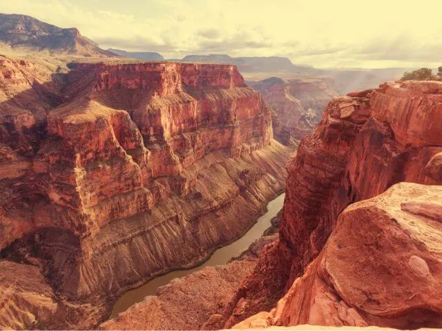
Grand Canyon National Park

 Year Established: 1919
Size: 1.2 million acres
Annual Visitors: 6.0 million
Best Time to Visit: March to May, September to October
Grand Canyon National Park Highlights: Hike South Kaibab, Hike Rim-to-Rim Trail, Visit South Rim viewpoints, Hike Bright Angel, Drive Hermit Road, take a flightseeing helicopter tour.
Grand Canyon National Park is located in northern Arizona and is home to the iconic Grand Canyon, a vast chasm that stretches over 277 miles long, up to 18 miles wide and over a mile deep. The canyon is considered one of the natural wonders of the world and is a UNESCO World Heritage Site. The park is also home to a diverse array of plants and animals, including the endangered California condor, bighorn sheep, and elk.
The park is popular with visitors who are interested in hiking, camping, and sightseeing. Visitors can hike to the bottom of the canyon along the Bright Angel or South Kaibab trails, take a scenic drive along Desert View Drive, or take a guided tour by mule. Visitors can also take a helicopter or plane tour to get an aerial view of the canyon.
The best time to visit the Grand Canyon National Park is between September and November, or March and May. During these months, the weather is mild, the crowds are thinner, and the fall foliage and spring wildflowers provide a colorful backdrop. Visitors should be aware that the park is incredibly busy in the summer months and it is recommended that visitors plan ahead to reserve campsites and tours in advance.
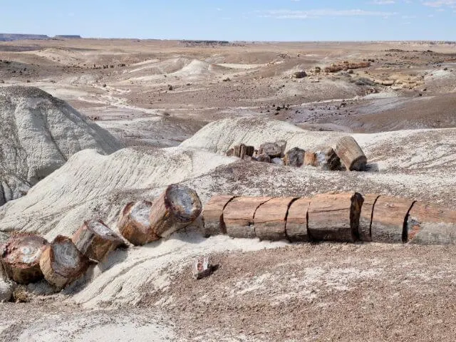
Petrified Forest National Park

 Year Established: 1962
Size: 146,900 acres
Annual Visitors: 640,000
Best Time to Visit: Late March to May and September to October.
Petrified Forest National Park Highlights: Tour Puerco Pueblo, See the Painted Desert and Blue Mesa, Hike Agate House, and see the petrified wood at Crystal Forest and on the Giant Logs Trail.
Petrified Forest National Park is located in northeastern Arizona and is known for its vast and colorful petrified wood, ancient fossils, and unique desert landscapes. The park’s most famous feature is the “Painted Desert”, a region of badlands that stretches for miles and features colorful rock layers of red, orange, and purple. The park also contains one of the largest and most colorful concentrations of petrified wood in the world, as well as ancient fossils of plants and animals that lived in the area over 225 million years ago.
Visitors to Petrified Forest National Park can explore the park’s many hiking trails, take a scenic drive along the park’s paved road, or visit the park’s two main visitor centers, which offer exhibits and educational programs. The park also offers guided ranger walks and talks, as well as backcountry hiking and camping opportunities.
The best time to visit Petrified Forest National Park is during the spring and fall, when the weather is mild and the crowds are thinner. The park’s colorful landscapes and rock formations are particularly beautiful during the spring and fall. Visitors should be aware that summer temperatures in the park can be extremely hot, and it is recommended that visitors plan ahead to reserve campsites and tours in advance.
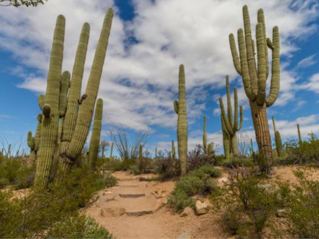
Saguaro National Park
 Year Established: 1994
Size: 91,716 acres
Annual Visitors: 1.0 million
Best Time to Visit: October to November and February to March
Saguaro National Park Highlights: Drive Scenic Bajada Loop and Cactus Forest Drive, Walk the Desert Discovery Nature Trail, and Hike the Desert Ecology Trail and King Canyon.
Saguaro National Park, located in southern Arizona, is a unique and beautiful desert landscape that is home to the iconic saguaro cactus, as well as a variety of other desert plants and animals. The park is divided into two distinct districts, the Rincon Mountain District and the Tucson Mountain District, each offering its own unique landscapes and hiking trails. The Rincon Mountain District is home to the highest concentration of saguaro cacti in the park and offers spectacular views of the surrounding mountains and desert.
The Tucson Mountain District is known for its more rugged terrain, and offers visitors the opportunity to explore the park’s unique desert landscape on foot or by car. The park’s main highlight is the saguaro cactus which is the largest cactus in the United States and can live up to 200 years old.
The best time to visit Saguaro National Park is during the spring and fall, when the weather is mild and the crowds are thinner. The park is particularly beautiful during the spring, when the cacti are in bloom and the wildflowers are in full bloom.
+ 17 National Park Units in Arizona
- Canyon de Chelly National Monument
- Casa Grande Ruins National Monument
- Chiricahua National Monument
- Coronado National Memorial
- Fort Bowie National Historic Site
- Hohokam Pima National Monument
- Hubbell Trading Post National Historic Site
- Montezuma Castle National Monument
- Navajo National Monument
- Organ Pipe Cactus National Monument
- Pipe Spring National Monument
- Sunset Crater Volcano National Monument
- Tonto National Monument
- Tumacacori National Historical Park
- Tuzigoot National Monument
- Walnut Canyon National Monument
- Wupatki National Monument
National Parks in Arkansas
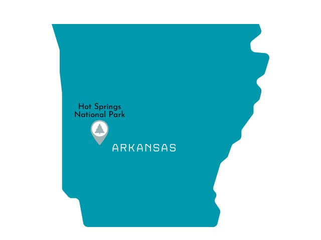
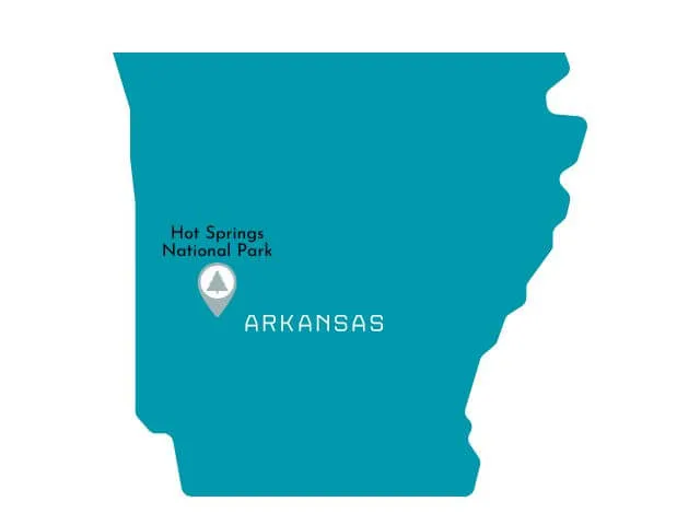
Hot Springs National Park

 Year Established: 1921
Size: 5,500 acres
Annual Visitors: 1.5 million
Best Time to Visit: September to November
Hot Springs National Park Highlights: Walk Bathhouse Row, Soak in the Hostsprings, see Balanced Rock, Hike Hot Springs Mountain, Visit Quapaw or Buckstaff Bathhouse.
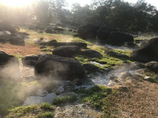
Hot Springs National Park, located in the state of Arkansas, is a unique and historic park that offers visitors the opportunity to experience the natural hot springs for which the park is named. The park is home to 47 natural hot springs, many of which can be accessed via the park’s historic bathhouse row, where visitors can take a dip in the hot springs and experience the therapeutic benefits of the mineral-rich water.
One of the park’s main highlights is the Hot Springs Mountain Tower, an observation tower that offers panoramic views of the surrounding area. Other popular activities in the park include hiking on the park’s 26 miles of trails, visiting the historic Fordyce Bathhouse Visitor Center, and obviously, taking a dip in the hot springs.
The best time to visit Hot Springs National Park is during the spring and fall, when the weather is mild and the crowds are thinner. The park is particularly beautiful during the fall, when the trees are changing color and the weather is cool. Visitors should be aware that the park’s facilities and roads may be closed due to inclement weather, and that it’s best to plan ahead to reserve campsites and tours in advance.
+ The 6 National Park Units in Arkansas
- Arkansas Post National Memorial
- Buffalo National River
- Fort Smith National Historic Site
- Little Rock Central High School National Historic Site
- Pea Ridge National Military Park
- President William Jefferson Clinton Birthplace Home National Historic Site
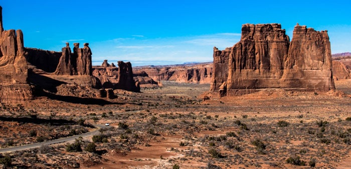
National Parks in California
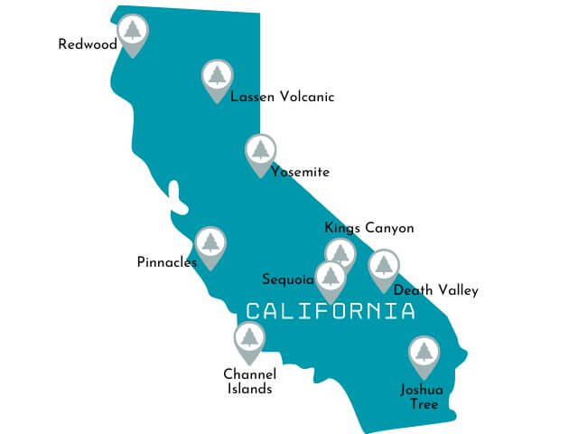

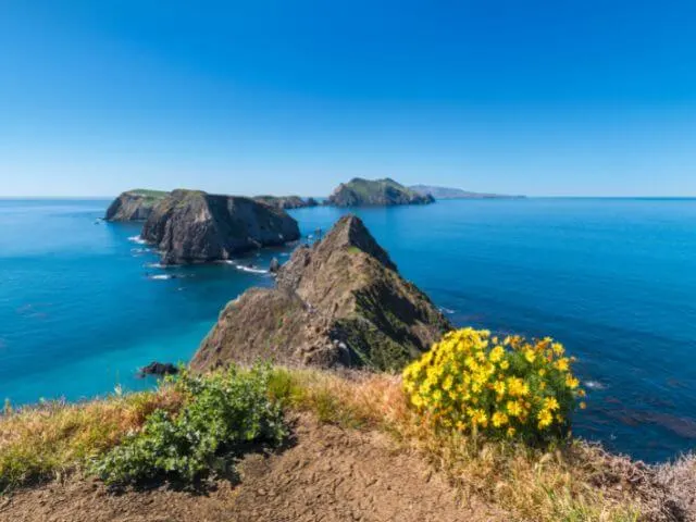
Channel Islands National Park

 Year Established: 1980
Size: 249,600 acres
Best Time to Visit: April to June and August to October
Annual Visitors: 410,000
Channel Islands National Park Highlights: Go Whale Watching, Kayak Santa Cruz Island, Hike Inspiration Point, Go Snorkelling.
Channel Islands National Park, located off the coast of California, is a unique and diverse destination for outdoor enthusiasts. The park is made up of five islands, each with its own ecosystem and array of wildlife.
Visitors can explore the islands through hiking, kayaking, and snorkeling, and even camp overnight on some of them. The park is also home to a wide variety of marine mammals and seabirds and features the largest sea cave in the world, the Painted Cave, on Santa Cruz Island.
The best time to visit is during the spring and fall when the weather is mild and the crowds are smaller.
Death Valley National Park

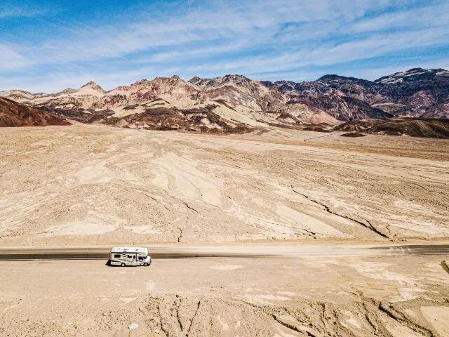 Note: Death Valley also crosses into Nevada and is the National Park closest to Las Vegas.
Year Established: 1994
Size: 3.37 million acres
Best Time to Visit: November to March
Annual Visitors: 1.7 million
Death Valley National Park Highlights: See Ubehebe Crater, visit Badwater Basin, Hike Mesquite Flat Sand Dunes at sunset, See Zabriskie Point at sunrise & stargaze.
Death Valley National Park is a unique and diverse destination located in the Mojave Desert in California. The park is known for its vast and unforgiving landscapes, including the lowest point in North America, Badwater Basin, and the hottest place in the world, Furnace Creek.
Visitors can explore the park through hiking, camping, and scenic drives, and should be aware that temperatures can reach extreme levels during the summer months, making it best to visit during the cooler months of fall, winter, and spring.
The park also offers a variety of other experiences, from visiting the historic mining town of Rhyolite to seeing the famous rock formations of Artist’s Drive and Zabriskie Point. Visitors should also be aware that the park is incredibly vast and remote, and it is important to come prepared with enough water and supplies.
Joshua Tree National Park
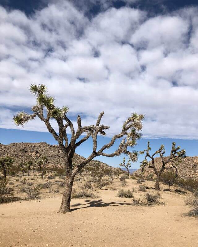
 Year Established: 1994
Annual Visitors: 3.0 million
Best Time to Visit: March to April, October to November
Joshua Tree National Park Highlights: Sunrise at the Cholla Cactus Garden, See Skull Rock, Drive to Keys View and Geology Tour Road, and Hike Ryan Mountain.
Joshua Tree National Park is a desert park located in southern California, known for its stunning rock formations and dense forests of Joshua Trees. Visitors can enjoy hiking, camping, and rock climbing in the park.
Spring and fall are the best seasons to visit, as temperatures are milder and wildflowers are in bloom. When planning a trip, it is important to bring plenty of water and protect yourself from the sun, as temperatures can reach over 100 degrees Fahrenheit during the summer months.
Additionally, it is important to note that some areas of the park may be closed due to preservation efforts, so it is a good idea to check the park’s website before visiting.
Kings Canyon National Park

 Year Established: 1940
Annual Visitors: 630,000
Best Time to Visit: June to October
Kings Canyon National Park Highlights: Hike Zumwalt Meadows, Backpack Rae Lakes Loop, Visit Grant Grove and Drive Kings Canyon Scenic Byway.
Kings Canyon National Park is located in the southern Sierra Nevada mountain range in California. The park is known for its deep canyons, towering granite cliffs, and towering sequoia trees. The park’s main attraction is the General Grant Tree, which is the second-largest tree in the world and is often referred to as the “Nation’s Christmas Tree.” The park also features the spectacular Kings Canyon, which is over a mile deep and is one of the deepest canyons in North America.
The best time to visit Kings Canyon National Park is during the summer months, from June to September. During this time, the weather is warm and sunny, and the roads and trails are clear. The park is also open year-round, but some of the higher elevations may be snow-covered during the winter months. Visitors should be prepared for varying weather conditions, and be aware of the park’s rules and regulations regarding camping, hiking and backpacking. It’s also recommended to bring plenty of water and be aware of the park’s bear safety guidelines.
Lassen Volcanic National Park
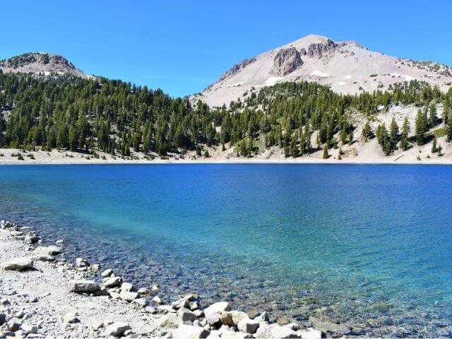
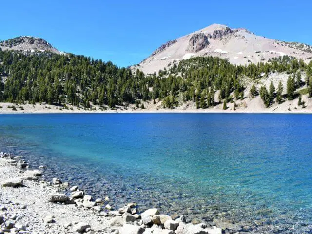 Year Established: 1916
Annual Visitors: 517,000
Best Time to Visit: June to October
Lassen Volcanic National Park Highlights: Hike Lassen Peak and Bumpass Hell, Drive Main Park Road, Visit Kings Creek Falls and See Manzanita Lake.
Lassen Volcanic National Park is located in Northern California and is known for its diverse volcanic landscapes. The park is home to Lassen Peak, the largest volcano in the park, which last erupted in 1915. Visitors can hike to the summit for panoramic views of the surrounding area.
The park also features hydrothermal areas with fumaroles, boiling mud pots, and hot springs, such as Bumpass Hell, which is one of the largest hydrothermal areas in the park.
The best time to visit Lassen Volcanic National Park is during the summer months, when the park’s main road and most of the park’s hiking trails are open. Visitors can also enjoy ranger-led programs, such as guided nature walks and campfire talks, during this time.
Winter also offers a unique opportunity to see the park’s volcanic features, such as snow-covered fumaroles and hot springs. However, visitors should be prepared for snowy and icy conditions and be aware that some park facilities and roads may be closed during this time.
Pinnacles National Park

 Year Established: 2013
Annual Visitors: 175,000
Best Time to Visit: March to May, September to November
Pinnacles National Park Highlights: Hike High Peaks Trail, Moses Spring and Bear Gulch, explore the Balconies cave, and spot California condors.
Pinnacles National Park is located in central California and is known for its unique rock formations and diverse array of flora and fauna. The park was established in 1913 and includes both the eastern and western sections of the Pinnacles formation, which were formed by volcanic activity 23 million years ago.
The park’s highlights include the impressive Pinnacles spires and rock formations, as well as the vast network of caves that run through the park. The park is also home to a wide variety of wildlife, including the California Condor, which can be spotted soaring above the park’s skies.
The best time to visit Pinnacles National Park is during the spring and fall months when the temperatures are mild and the wildflowers are in bloom. Summer can be quite hot, and the park can get crowded, so it is best to visit early in the morning or later in the day during the summer months.
Visitors should also be aware that the park has limited water resources, so it’s important to bring plenty of water when visiting. Hiking and rock climbing are popular activities in the park, but visitors should also be prepared for steep and rocky terrain.
Redwood National Park
 Year Established: 1968
Annual Visitors: 500,000
Best Time to Visit: March to November
Redwood National Park Highlights: Hike Boy Scout Tree Trail and Tall Trees Grove, See Stout Grove, and drive the Newton B. Drury Scenic Byway.
Redwood National Park, located in northern California, is home to some of the tallest and oldest trees in the world. The park is made up of four separate units, including Redwood National Park, Jedediah Smith Redwoods State Park, Del Norte Coast Redwoods State Park and Prairie Creek Redwoods State Park.
The park is a haven for hikers, with over 100 miles of trails that wind through towering old-growth redwoods and along scenic coastal cliffs. Visitors can also enjoy fishing, biking, and horseback riding in the park.
One of the main highlights of Redwood National Park is the chance to see the ancient redwood trees, some of which are over 2,000 years old. The park is also home to a diverse array of wildlife, including black bears, Roosevelt elk, and marbled murrelets. The park’s coastal area also offers opportunities for beachcombing, tidepooling and birdwatching.
The best time to visit the park is during the summer, when the weather is mild and the days are longest. However, it is always recommended to check the weather forecast and pack accordingly as the weather can change rapidly in the park.
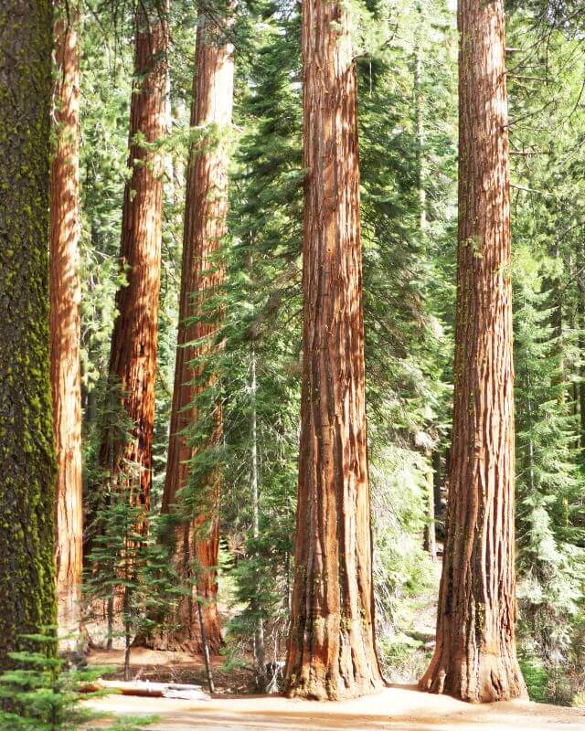
Sequoia National Park
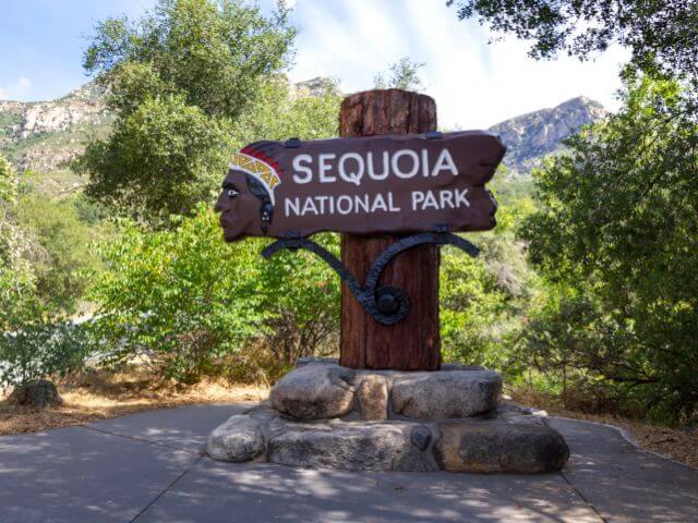
 Year Established: 1890
Annual Visitors: 1.3 million
Best Time to Visit: June to October
Sequoia National Park Highlights: Drive under Tunnel Log, Hike Big Trees Trail and Moro Rock, and See the General Sherman tree.
Sequoia National Park is located in California’s southern Sierra Nevada mountain range. The park is known for its giant sequoia trees, which are some of the largest and oldest living organisms on Earth. The park’s most famous tree, the General Sherman Tree, is considered the largest tree in the world by volume. The park also boasts impressive granite cliffs, deep canyons, and a variety of wildlife.
The best time to visit Sequoia National Park is during the spring and fall seasons. During these times, the weather is mild and the crowds are less. Summer can get very hot, and winter can bring heavy snowfall, making some areas of the park inaccessible. Visitors should also be aware that some of the park’s main roads and trails may close during the winter season. At the opposite end of the spectrum, the park can get quite busy during summer weekends, so try to plan your visit during the week to avoid the crowds.
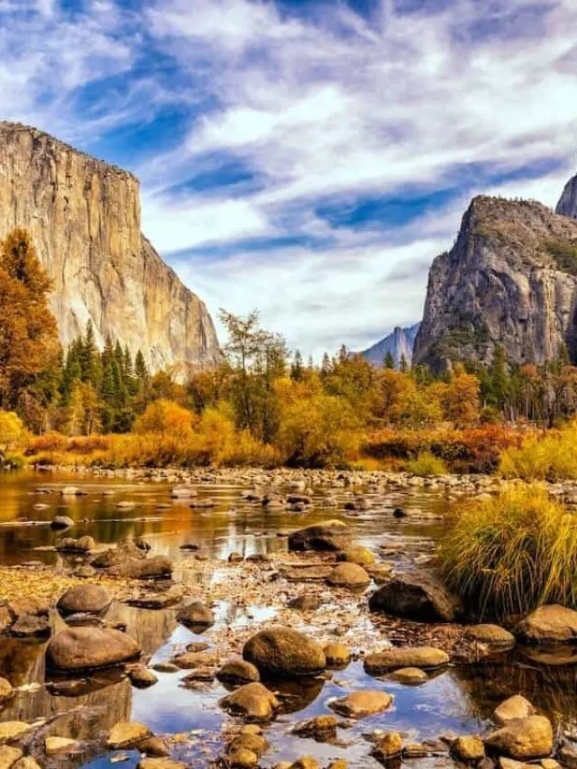
Yosemite National Park
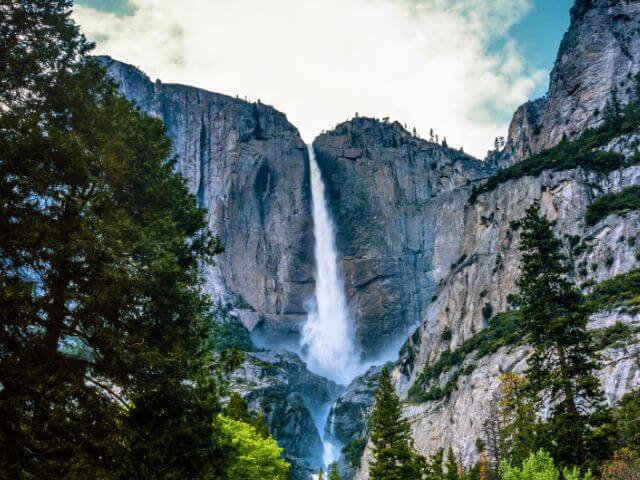
 Year Established: 1890
Annual Visitors: 4.4 million
Best Time to Visit: June to October
Yosemite National Park Highlights: Hike Yosemite Falls and Half Dome, Watch the Sunset at Taft Point, See Bridalveil Falls, hike the Mist Trail to Vernal and Nevada Falls and Explore Yosemite Valley.
Yosemite National Park is located in the Sierra Nevada mountains in California and is known for its spectacular granite cliffs, waterfalls, and giant sequoia groves. The park was first protected in 1864 and is now one of the most popular national parks in the country, with over 4 million visitors annually.
The park is home to some of the most iconic landmarks in the United States, including Half Dome and El Capitan, which are popular spots for rock climbing. The park also offers a variety of outdoor activities such as hiking, camping, and backpacking, as well as scenic drives and ranger-led programs.
One of the best times to visit Yosemite National Park is during the spring and fall, when the crowds are smaller and the weather is mild. In the spring, wildflowers are in bloom and the waterfalls are at their peak flow. In the fall, the deciduous trees turn beautiful shades of orange and gold.
Visitors should also be aware that the park can be quite busy during the summer months, so it is best to plan ahead and make reservations for camping or lodging. Also, it is recommended to bring warm clothing as temperatures can drop significantly, even during the summer.
+ The 10 National Park Units in California
- Cabrillo National Monument
- Castle Mountains National Monument
- César E. Chávez National Monument
- Devils Postpile National Monument
- Eugene O’Neill National Historic Site
- Fort Point National Historic Site
- Golden Gate National Recreation Area
- John Muir National Historic Site
- Lava Beds National Monument
- Manzanar National Historic Site
- Mojave National Preserve
- Muir Woods National Monument
- Point Reyes National Seashore
- Port Chicago Naval Magazine National Memorial
- Rosie the Riveter/World War II Home Front National Historical Park
- San Francisco Maritime National Historical Park
- Santa Monica Mountains National Recreation Area
- Tule Lake National Monument
- Whiskeytown-Shasta-Trinity National Recreation Area
National Parks in Colorado
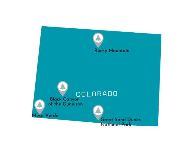

Black Canyon of the Gunnison National Park
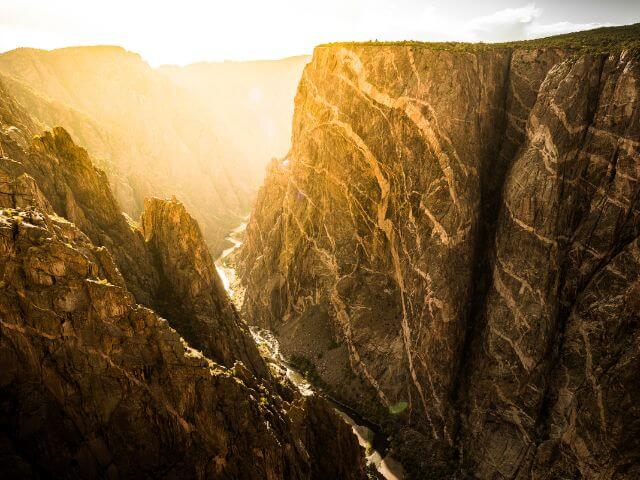
 Year Established: 1999
Annual Visitors: 430,000
Best Time to Visit: May to October
Black Canyon of the Gunnison NP Highlights: Hike to Warner Point, See Gunnison Point and Exclamation Point, Drive East Portal Road & South Rim Road
Black Canyon of the Gunnison National Park is located in western Colorado and is known for its steep and dramatic canyon walls. The park’s main feature is the Black Canyon, which was carved by the Gunnison River over millions of years. The park is open year-round, but the best time to visit is during the spring and fall when the temperatures are mild and the crowds are smaller.
The park offers a variety of recreational activities such as hiking, camping, and fishing. Visitors can hike down to the river on the North Rim Road and take in the breathtaking views of the canyon, although it is important to note that some of the park’s trails are strenuous and not suitable for all hikers. The park also offers ranger-led programs, including guided canyon floor hikes and stargazing programs.
Great Sand Dunes National Park
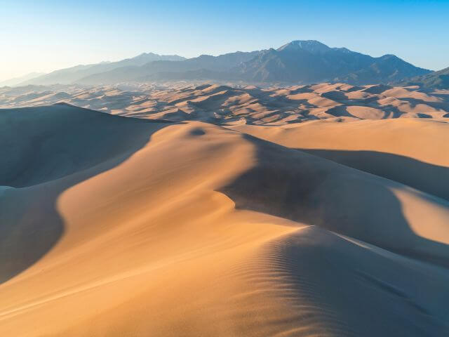
 Year Established: 2004
Annual Visitors: 530,000
Best Time to Visit: March to May, September to November
Great Sand Dunes National park Highlights: Go Sandboarding, Go Stargazing, and Hike Dunes Overlook, High Dune and Star Dune.
Great Sand Dunes National Park is located in southern Colorado and is home to the tallest dunes in North America. The park was established in 1932 and covers an area of over 150,000 acres. The dunes were formed by the erosion of the Sangre de Cristo Mountains, which caused the wind to blow sand onto the valley floor.
Visitors can enjoy a variety of activities within the park such as sandboarding, hiking, and horseback riding.
The best time to visit Great Sand Dunes National Park is in the summer months, when temperatures are warm and the park’s facilities are open. However, visitors should be aware that the park can get very hot during the day, so it’s best to plan outdoor activities for early in the morning or later in the evening. Additionally, visitors should come prepared with plenty of water, sunscreen, and sturdy shoes as the sand can be quite hot to walk on.
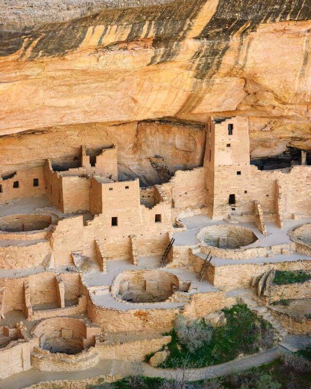
Mesa Verde National Park
 Year Established: 1906
Annual Visitors: 550,000
Best Time to Visit: June to September
Mesa Verde National Park Highlights: Hike Petroglyph Point, drive Mesa Top Loop, Tour Cliff Palace and the Balcony House.
Mesa Verde National Park is located in the southwestern United States in the state of Colorado. The park was established in 1906 in order to preserve the ancient Puebloan cliff dwellings, which are believed to have been built by the Ancestral Puebloans people between 600 and 1300 AD. These dwellings are some of the best-preserved examples of ancient architecture in the United States.
The park’s main highlights include the Cliff Palace, the largest cliff dwelling in the park and one of the most famous in the world, and Balcony House, a smaller dwelling that requires visitors to climb a series of ladders and crawl through a tunnel to reach it. Other highlights include the Long House, Spruce Tree House and the Sun Temple.
The best time to visit Mesa Verde National Park is during the spring and fall when the temperatures are mild and the crowds are smaller. Visitors should also note that some of the park’s dwellings are only accessible via guided tours, so it is recommended to book ahead of time.
Hiking is also a great way to explore the park and take in the natural beauty of the area.
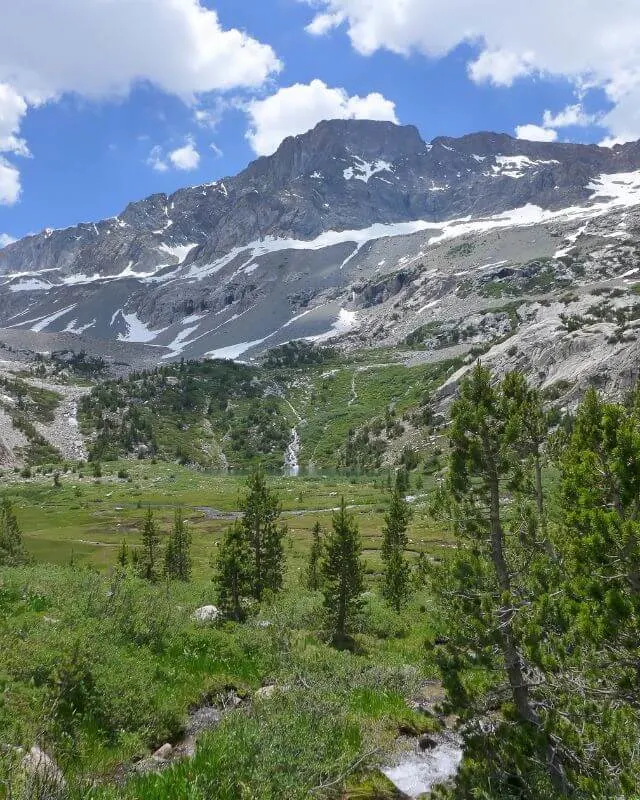
Rocky Mountain National Park
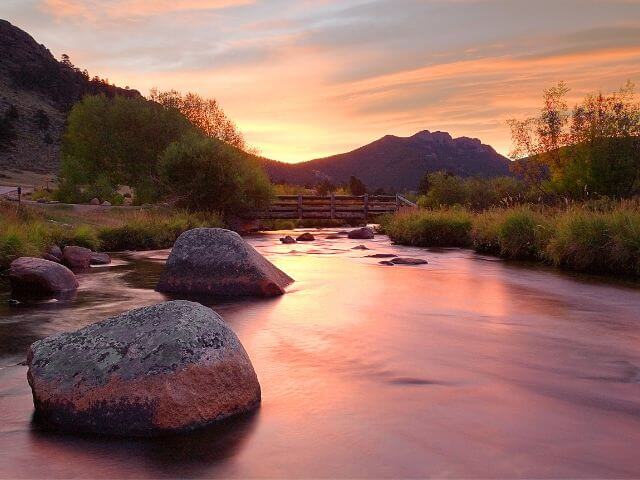
 Year Established: 1915
Annual Visitors: 4.7 million
Best Time to Visit: June to September
Rocky Mountain National Park Highlights: Hike Sprague Lake, Emerald Lake and Sky Pond Lake, Drive Trail Ridge Road
Rocky Mountain National Park is located in northern Colorado (and is the national park nearest to Denver). It spans over 415 square miles of rugged mountain terrain.
The park is home to a diverse array of wildlife, including elk, bighorn sheep, and moose, as well as over 300 miles of hiking trails that offer breathtaking views of the park’s peaks, valleys, and alpine lakes.
The park’s highest peak, Longs Peak, stands at 14,259 feet and is a popular destination for experienced hikers and climbers.
The best time to visit Rocky Mountain National Park depends on what type of activities you plan on doing. The park is open year-round, but certain seasons offer different experiences.
Summer is the most popular time to visit, with mild temperatures and wildflowers in bloom. This is also the best time for hiking and camping. Winter offers the opportunity to see the park’s wildlife and enjoy winter sports such as cross-country skiing and snowshoeing. Spring and fall are also great times to visit, as the park’s colors change with the changing of the seasons.
Visitors should be prepared for variable weather and bring appropriate clothing and gear. It is also important to be aware of altitude sickness and take necessary precautions when planning your trip.
Other Colorado National Park Units
- Bent’s Old Fort National Historic Site
- Colorado National Monument
- Curecanti National Recreation Area
- Dinosaur National Monument
- Florissant Fossil Beds National Monument
- Hovenweep National Monument
- Sand Creek Massacre National Historic Site
- Yucca House National Monument
Florida National Parks

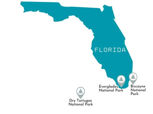
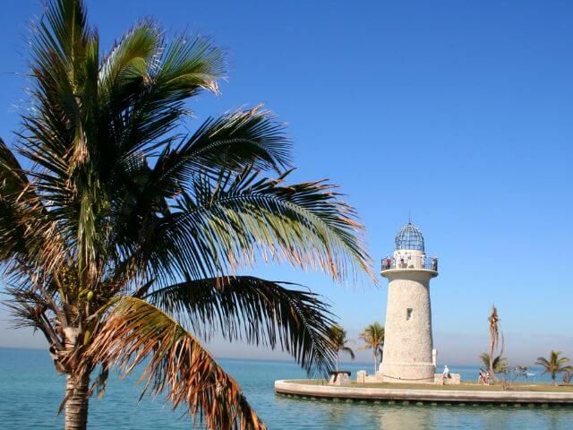
Biscayne National Park
 Year Established: 1980
Annual Visitors: 710,000
Best Time to Visit: December to February
Biscayne National Park Highlights: Hike Elliot Key, boat tour to Boca Chita Key, Snorkel the barrier reef and Maritime Heritage Trail, and go kayaking or paddle boarding in Jones Lagoon.
Biscayne National Park is located in southern Florida and is known for its unique combination of marine and terrestrial environments. The park is home to four distinct ecosystems: mangrove forest, the Florida Keys, Biscayne Bay, and coral reefs. The park offers visitors a variety of activities such as snorkeling, diving, fishing, and boating.
The best time to visit Biscayne National Park is during the winter months, from December to April, when the weather is mild and the water is clear.
Visitors should keep in mind that much of the park is only accessible by boat, so be sure to plan accordingly. It is also important to note that the park has strict regulations regarding the protection of its marine life, so be sure to check the park’s website for specific rules and guidelines before visiting. Also, consider bringing sunscreen and insect repellent as the sun and bugs can be intense (even in winter!)
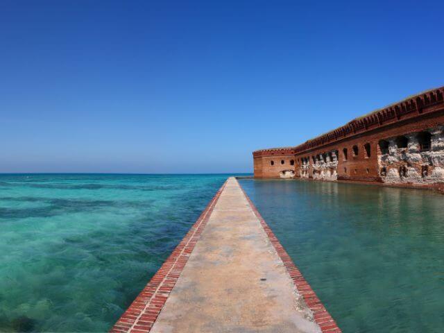
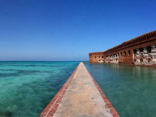
Dry Tortugas National Park
 Year Established: 1992
Annual Visitors: 80,000
Best Time to Visit: December to February, April to May
Dry Tortugas National Park Highlights: Tour Fort Jefferson, Stroll Bush Key, and Snorkel Garden Key.
Dry Tortugas National Park is a remote island park located in the Gulf of Mexico, approximately 70 miles west of Key West, Florida. The park is known for its crystal clear waters, abundant marine life, and historic Fort Jefferson.
The park is accessible only by boat or seaplane, and the main attraction is the historic Fort Jefferson, which was built in the mid-19th century and served as a military prison during the Civil War.
The park’s waters are a popular spot for snorkeling and scuba diving, as the clear waters offer visibility of up to 100 feet. Visitors can also enjoy birdwatching, as the park is home to over 200 species of birds, including the sooty tern and brown noddy.
The best time to visit Dry Tortugas National Park is during the spring and fall when the weather is mild and the waters are calm. Visitors should be prepared for hot and humid weather during the summer months, and should also bring plenty of sunscreen and drinking water as there are limited facilities on the islands.
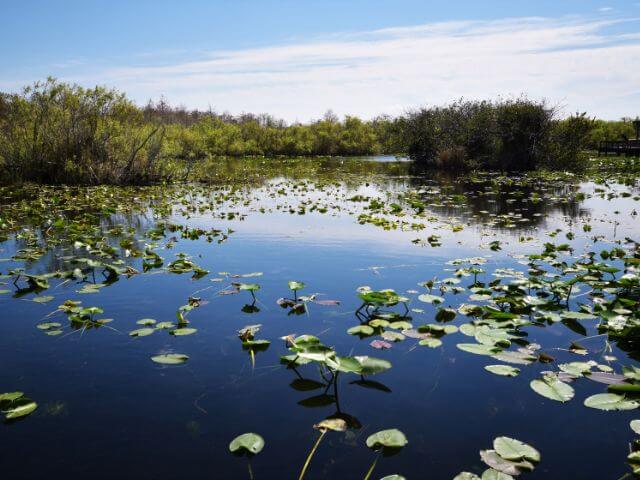
Everglades National Park
 Year Established: 1934
Annual Visitors: 1.1 million
Best Time to Visit: December to February
Everglades National Park Highlights: See Shark Valley, Spot Manatee & Crocodile, Hike Anhinga Trail
Everglades National Park is a unique and expansive natural wonder located in southern Florida. The park, which was established in 1947, covers over 1.5 million acres and is home to a diverse array of plant and animal species.
The park’s primary attraction is the River of Grass, a slow-moving river of sawgrass that flows through the park. Visitors can explore the park by taking an airboat tour, hiking on one of the many trails, or by taking a guided tram tour.
The best time to visit the park is during the dry season, which typically runs from November to April. During this time, the weather is milder and the mosquitoes are less prevalent. Visitors should also be prepared for hot and humid conditions, as well as the possibility of thunderstorms.
It is also important to note that the park is home to several dangerous animals, such as alligators and crocodiles, so visitors should always be cautious and follow posted safety guidelines. Consider bringing binoculars, sunscreen, and insect repellent. It is also advisable to wear closed-toe shoes and light-colored clothing to avoid sunburn.
Other Florida National Park Units
- Big Cypress National Preserve
- Canaveral National Seashore
- Castillo de San Marcos National Monument
- De Soto National Memorial
- Fort Caroline National Memorial
- Fort Matanzas National Monument
- Gulf Islands National Seashore
- Timucuan Ecological and Historic Preserve
National Parks in Hawaii

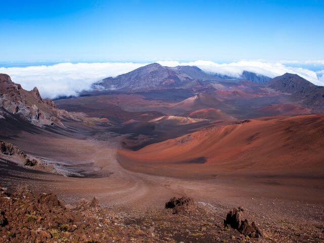
Haleakalā National Park
 Year Established: 1961
Annual Visitors: 995,000
Best Time to Visit: December to April
Haleakala National Park Highlights: See Haleakalā Summit at sunrise, Hike Pīpīwai Trail, visit the Seven Sacred Pools of ‘Ohe’o, Drive the nearby Road to Hāna
Haleakalā National Park is a national park located in Hawaii on the island of Maui. The park is best known for its main feature, the Haleakala volcano, which last erupted in 1790. The park offers a variety of activities for visitors including hiking, camping, and stargazing.
The park also offers a unique opportunity to witness sunrise from the summit of the volcano, a popular activity among visitors.
The best time to visit Haleakala National Park is during the months of April through September, as the weather is typically drier during these months. Visitors should also note that the summit of the volcano reaches an elevation of over 10,000 feet and can be quite chilly, so it is important to bring warm clothing.
Additionally, the park’s roads can be narrow and winding, so it is important to drive with caution. Overall, Haleakalā National Park offers visitors a chance to experience the natural beauty and unique geology of Hawaii.
Hawaii Volcanoes National Park

 Year Established: 1916
Annual Visitors: 1.4 million
Best Time to Visit: All year
Hawaii Volcanoes National Park Highlights: Hike Thurston Lava Tube Trail, Drive Crater Rim and Chain of Craters Road, View lava flow at Halema’uma’u Crater.
Hawai’i Volcanoes National Park is located on the Big Island of Hawaii and is home to two of the world’s most active volcanoes, Kīlauea and Mauna Loa. The park was established in 1916 and spans over 323,000 acres. It is home to a diverse array of plant and animal life, including the endangered Hawaiian goose and the rare Hawaiian silversword plant.
One of the main highlights of the park is the opportunity to see active volcanic activity. Visitors can hike to the summit of Kilauea to see the volcano’s caldera and the Halema’uma’u crater, or take a drive on the Chain of Craters Road to see the results of past eruptions.
The park also features several hiking trails, including the Devastation Trail, which takes visitors through a forest devastated by volcanic activity.
The best time to visit the park is during the drier months, from April to September. Visitors should also be aware that volcanic activity can affect trail and road closures, so it is important to check with the park for the latest updates before planning a trip.
+ 6 National Park Units in Hawaii
- Honouliuli National Historic Site
- Kalaupapa National Historical Park
- Kaloko-Honokōhau National Historical Park
- Pearl Harbor National Memorial
- Pu’uhonua o Hōnaunau National Historical Park
- Pu’ukoholā Heiau National Historic Site
Indiana National Parks

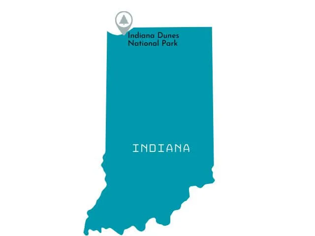
Indiana Dunes National Park
 Year Established: 2019
Annual Visitors: 2.1 million
Best Time to Visit: March to May, September to November
Highlights: Hike West Beach and the Dunes Succession Trail, Swim in Lake Michigan, Enjoy the beach, Tour Mount Baldy.
Indiana Dunes National Park is located on the southern shore of Lake Michigan in northwest Indiana. The park was established in 1966 and covers approximately 15,000 acres. It is known for its diverse ecosystem and recreational opportunities, including 15 miles of pristine beaches, sand dunes, wetlands, prairies, and forests.
The best time to visit Indiana Dunes National Park is during the spring and fall when the weather is mild and the crowds are smaller. Visitors can enjoy hiking, swimming, fishing, and bird-watching during these seasons.
During the summer, the park’s beaches can get quite crowded, but it’s still a good time to visit if you don’t mind the crowds. In the winter, the park offers cross-country skiing and snowshoeing opportunities.
+2 Indiana National Park Units
- George Rogers Clark National Historical Park
- Lincoln Boyhood National Memorial
Kentucky National Parks
Mammoth Cave National Park

 Year Established: 1941
Annual Visitors: 550,000
Best Time to Visit: March to April, October to November
Highlights: Take a guided cave tour and Hike River Styx Spring Trail
Mammoth Cave National Park is located in central Kentucky and is home to the longest-known cave system in the world. The park’s history dates back to the early 1800s, when the first commercial tours of the cave were offered.
The cave system is made up of more than 400 miles of passageways and is a popular destination for visitors interested in exploring the underground world.
Some of the highlights of Mammoth Cave National Park include the historic tour, which takes visitors through the cave’s most famous passageways, and the wild cave tour, which is an adventure for those who want to explore more challenging sections of the cave. The park also offers a variety of outdoor activities, including hiking, camping, and fishing.
The best time to visit Mammoth Cave National Park is during the spring and fall when the temperatures are mild and the crowds are smaller. Visitors should consider that the cave’s temperature is always around 54 degrees Fahrenheit and having an extra layer or sweater is never a bad idea, even if you don’t feel the cold!
+4 National Park Units in Kentucky
- Abraham Lincoln Birthplace National Historical Park
- Camp Nelson National Monument
- Cumberland Gap National Historical Park
- Mill Springs Battlefield National Monument
Maine National Parks

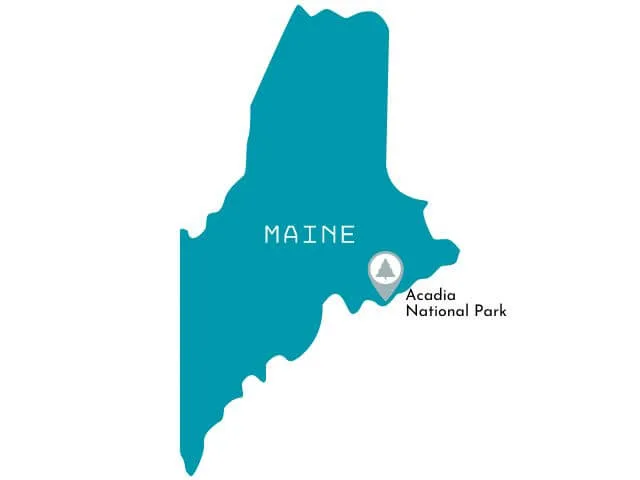
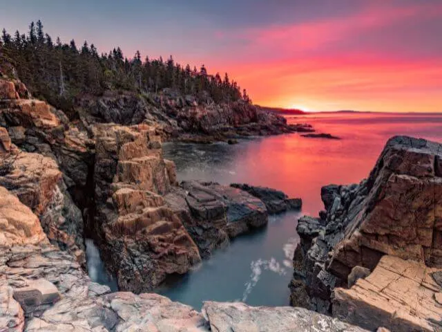
Acadia National Park

 Year Established: 1919
Annual Visitors: 3.4 million
Best Time to Visit: September to October
Acadia National Park Highlights: Drive Park Loop Road, See Cadillac Mountain, Hike the Precipice Trail, See Bass Harbor Head Lighthouse & visit Sand Beach and Echo Lake.
Acadia National Park is located on the rugged coast of Maine and is known for its beautiful mountains, rocky beaches and hiking trails. The park was established in 1919 and covers more than 49,000 acres of land.
One of the main highlights of the park is Cadillac Mountain, which is the tallest peak on the east coast of the United States and offers spectacular views of the surrounding area. Visitors can also take a drive on the Park Loop Road, a 27-mile road that passes by many of the park’s main sights, including Jordan Pond and Sand Beach.
The best time to visit Acadia National Park is during the summer months, from June to September, when the weather is warm and the days are long. During this time, visitors can take advantage of the many hiking trails, campgrounds, and picnic areas that the park has to offer. However, it’s important to note that the park can get quite crowded during the summer months, so it’s best to plan ahead and make reservations for camping or lodging.
In addition, visitors should also be aware that some of the park’s facilities and services are closed during the winter months, from November to April, but cross-country skiers and snowshoers can enjoy the 45 miles of carriage roads (nearly 32 of which are groomed) and unplowed park roads,
+2 National Park Units in Maine
- Katahdin Woods and Waters National Monument
- Saint Croix Island International Historic Site
Michigan National Parks

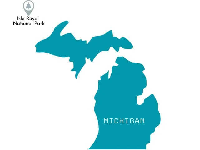
Isle Royale National Park
 Year Established: 1940
Annual Visitors: 25,000
Best Time to Visit: July to August
Isle Royale National Park Highlights: Hike Stoll Trail, Canoe/Kayak, Go backcountry camping.
Isle Royale National Park is a remote island located in Lake Superior, near the border of Minnesota and Ontario, Canada. It is known for its rugged wilderness and remote location, as well as its diverse array of flora and fauna.
Visitors to the park can explore its many hiking trails, take a boat tour, or even camp overnight in the wilderness.
The best time to visit Isle Royale National Park is during the summer months, from June to September. This is when the weather is warmest and the days are the longest, allowing for the most opportunities to explore the park.
Visitors should be prepared for the park’s remote location and bring necessary supplies and equipment, such as camping gear, bug spray, and sturdy hiking boots. Additionally, be prepared for changing weather conditions and bring appropriate clothing.
+4 Michigan National Park Units in Michigan
- Keweenaw National Historical Park
- Pictured Rocks National Lakeshore
- River Raisin National Battlefield Park
- Sleeping Bear Dunes National Lakeshore
Minnesota National Parks
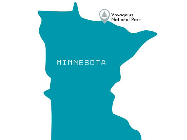

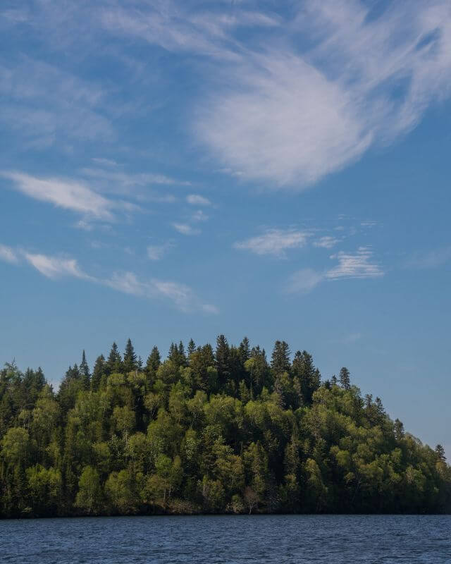
Voyageurs National Park

 Year Established: 1975
Annual Visitors: 230,000
Best Time to Visit: June to September
Voyageurs National Park Highlights: See the Northern Lights, Hike Cruiser Lake Trail and Echo Bay Trail, Canoe the North Canoe Voyage
Voyageurs National Park is a unique and beautiful destination for outdoor enthusiasts. The park is known for its interconnected network of waterways, making it a popular destination for boating and canoeing. Visitors can explore the park’s many lakes and channels, observing the diverse array of wildlife that call the park home, such as beavers, loons, and otters.
The park also offers a variety of land-based activities, such as hiking and camping. Hikers can explore the park’s scenic trails, taking in views of the surrounding wilderness and the many lakes that dot the landscape.
The park is also home to several historic sites, such as the Kettle Falls Hotel, which offers a glimpse into the park’s rich history.
The best time to visit Voyageurs National Park is during the summer months when the weather is warm and comfortable and the waterways are open for boating. However, visitors should be prepared for the possibility of mosquitoes and other insects, especially during peak season.
+3 National Park Units in Minnesota
- Grand Portage National Monument
- Mississippi National River and Recreation Areas
- Pipestone National Monument
Missouri National Parks

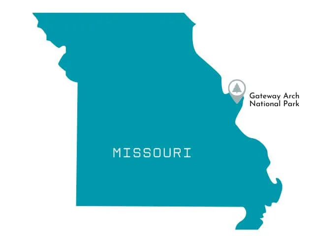
Gateway Arch National Park

 Note: Gateway Arch crosses into Illinois too.
Year Established: 2018
Annual Visitors: 2.1 million
Best Time to Visit: May to October
Gateway Arch National Park Highlights: Go to the top of the Arch on the tram, Visit the Old Courthouse.
Gateway Arch National Park, located in St. Louis, Missouri, is home to the iconic Gateway Arch. This 630-foot tall monument was built in the 1960s to commemorate the westward expansion of the United States.
Visitors can take a tram to the top of the arch for a breathtaking view of the city. The park also offers a museum that details the history of the arch and the role of St. Louis in the western expansion.
The best time to visit Gateway Arch National Park is in the spring or fall when the weather is mild and the crowds are smaller.
Visitors should also consider taking a riverboat cruise on the Mississippi River to get a different perspective of the arch.
Additionally, the park offers a variety of ranger-led tours and other activities, such as bike and Segway rentals, for visitors to fully experience the park.
+6 National Park Units in Missouri
- George Washington Carver National Monument
- Harry S Truman National Historic Site
- Ozark National Scenic Riverways
- Ste. Genevieve National Historical Park
- Ulysses S. Grant National Historic Site
- Wilson’s Creek National Battlefield
Montana National Parks

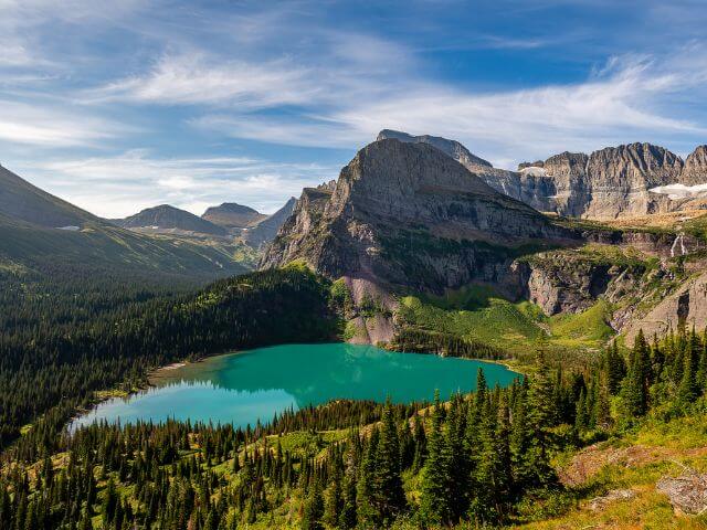
Glacier National Park
 Year Established: 1910
Annual Visitors: 3.1 million
Best Time to Visit: June to September
Glacier National Park Highlights: Drive Going-to-the-Sun Road, Hike Grinnell Glacier and Hidden Lake, Hike the Highline Trail, see Wild Goose Island, visit Many Glacier, Enjoy Lake McDonald
Glacier National Park is located in the northern Rocky Mountains of Montana and encompasses over 1 million acres of rugged wilderness. It was established as a national park in 1910 and is known for its spectacular landscapes, including glaciers, alpine meadows, and rugged peaks.
The park is home to over 700 miles of hiking trails, which provide visitors with the opportunity to explore the diverse ecosystems of the park.
The best time to visit Glacier National Park is during the summer months, from June to September, when the weather is mild and the snow has melted. This is the peak season for visitors, but it is also the best time to experience the park’s natural beauty.
Visitors should be prepared for varying weather conditions, as well as wildlife encounters. It is also recommended to bring appropriate footwear and clothing, as well as plenty of water, as some trails can be steep and strenuous.
+4 National Park Units in Montana
- Big Hole National Battlefield
- Bighorn Canyon National Recreation Area
- Grant-Kohrs Ranch National Historic Site
- Little Bighorn Battlefield National Monument
Nevada National Parks

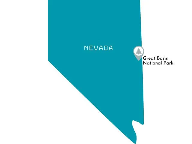
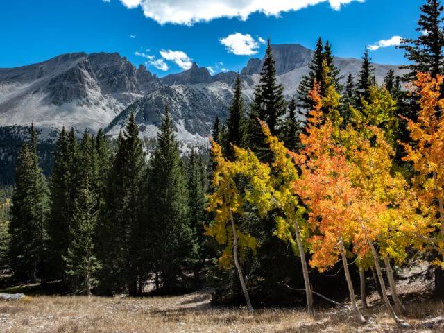
Great Basin National Park
 Year Established: 1986
Annual Visitors: 130,000
Best Time to Visit: April to October
Great Basin National Park Highlights: Hike Bristlecone Trail and the Alpine Loop Trail, Drive Wheeler Peak Scenic Drive, Go Stargazing, and Tour Lehman Caves.
Great Basin National Park is known for its beautiful landscapes and diverse array of plant and animal life.
The park’s centerpiece is the 13,063-foot-tall Wheeler Peak, which is the second-highest peak in Nevada. Visitors to the park can hike to the top of the peak, which offers stunning views of the surrounding mountains and valleys. The park also offers a variety of other outdoor activities such as camping, picnicking, and bird watching.
The best time to visit Great Basin National Park is during the summer months, when the weather is mild and the park’s wildflowers are in full bloom. Fall is also a great time to visit, as the aspens and cottonwoods turn golden yellow.
Winter can be very cold and snowy, but it’s also a great time for cross-country skiing and snowshoeing. Visitors should be aware that many of the park’s trails and roads are not maintained during the winter months, so proper planning and equipment are essential.
+2 National Park Service Units in Nevada
- Lake Mead National Recreation Area
- Tule Springs Fossil Beds National Monument
New Mexico National Parks
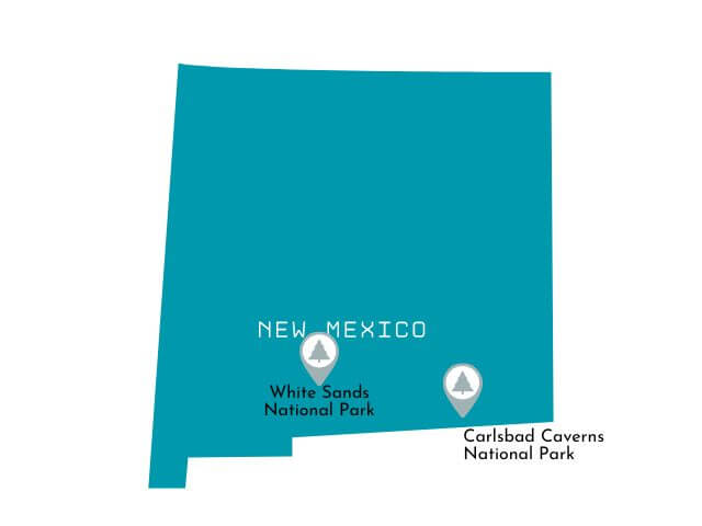

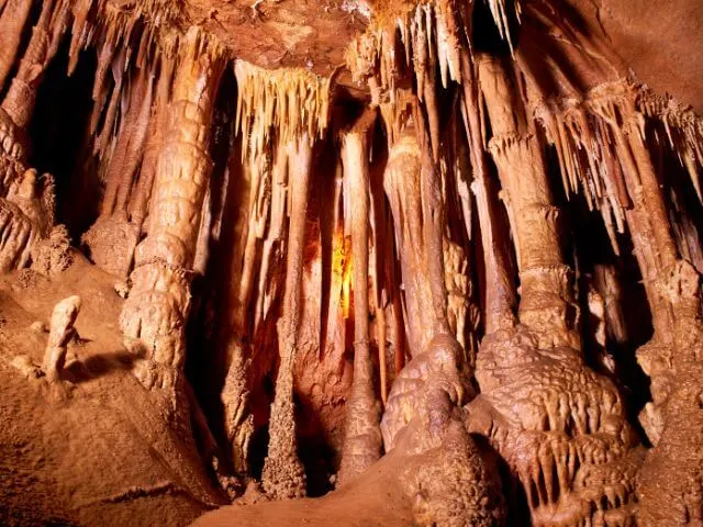
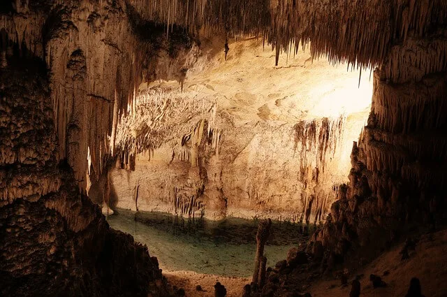
Carlsbad Caverns National Park

 Year Established: 1930
Annual Visitors: 440,000
Best Time to Visit: All Year
Carlsberg Caverns NP Highlights: Ranger-led tour of King’s Palace Cave, Self-guided tour of Big Room and watching the Bat Vortex as they take flight for the night
Carlsbad Caverns National Park is located in the Guadalupe Mountains of southeastern New Mexico and is known for its limestone caves, including the famous Carlsbad Cavern.
The park’s history dates back to the late 1800s, when the caverns were first discovered and explored by local cowboys and settlers. The park was officially established in 1930 and was designated a World Heritage Site in 1995.
The main highlight of the park is the Carlsbad Cavern, which visitors can explore through self-guided tours or ranger-led tours. The cavern is home to thousands of bats, which can be observed during the evening bat flight program. The park also offers hiking trails, a visitor center, and a campground.
The best time to visit Carlsbad Caverns National Park is during the spring and fall when temperatures are mild. Considerations for visitors include that the cave temperature is always around 56 degrees Fahrenheit and that the park is at an elevation of 4,000 feet, so those with respiratory issues should be aware.
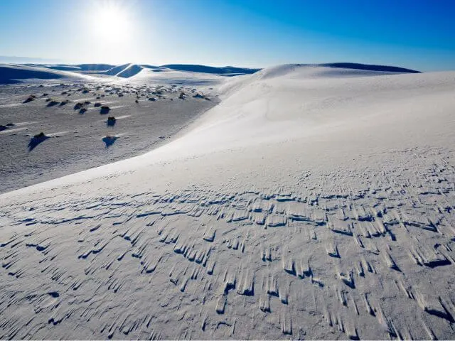
White Sands National Park

 Year Established: 2019
Annual Visitors: 610,000
Best Time to Visit: October to May
White Sands National Park Highlights: Drive Dunes Drive, Hike Interdune Boardwalk, walk the Dune Life Nature Trail, and Sled the dunes.
White Sands National Park is located in southern New Mexico, and is known for its vast expanse of white gypsum sand dunes. The park’s unique landscape was formed by the erosion of the surrounding mountains, which created the gypsum deposits that now cover the park’s 275 square miles.
The park is also home to a diverse array of plant and animal life, and visitors can enjoy a variety of outdoor activities such as hiking, camping, and picnicking.
The best time to visit White Sands National Park is between October and May, as the summer months can be extremely hot and dry. Visitors should also be prepared for sun exposure, as there is little shade in the park. Consider bringing sunscreen, sunglasses, and a hat, as well as enough water to stay hydrated. It is also recommended to wear closed-toed shoes and to stay on designated trails to avoid getting lost.
The park also offers ranger-led tours, guided walks, and full-moon night hikes that provide a unique perspective on the park’s natural beauty.
+13 National Park Service Units in New Mexico
- Aztec Ruins National Monument
- Bandelier National Monument
- Capulin Volcano National Monument
- Chaco Culture National Historical Park
- El Malpais National Monument
- El Morro National Monument
- Fort Union National Monument
- Gila Cliff Dwellings National Monument
- Manhattan Project National Historical Park
- Pecos National Historical Park
- Petroglyph National Monument
- Salinas Pueblo Missions National Monument
- Valles Caldera National Preserve
North Dakota National Parks
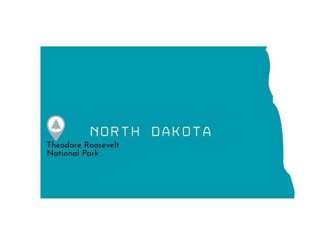

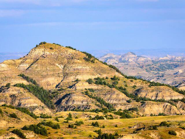
Theodore Roosevelt National Park
 Year Established: 1978
Annual Visitors: 690,000
Best Time to Visit: May to September
Theodore Roosevelt National Park Highlights: Drive Scenic Loop, Hike Painted Canyon and Caprock Coulee Trail, See Oxbow Bend Overlook & River Bend Overlook.
Theodore Roosevelt National Park is located in western North Dakota and covers over 70,000 acres of rugged Badlands terrain. The park was named after the 26th President of the United States, Theodore Roosevelt, who visited the area in the 1880s and was so inspired by the rugged beauty of the Badlands that he later established the park.
The park features two distinct units: the North Unit and the South Unit. The North Unit is home to the park’s main visitor center and offers scenic drives, hiking trails, and wildlife viewing opportunities. The South Unit is more remote and offers a more rugged hiking experience.
The highlights of Theodore Roosevelt National Park include the colorful Badlands formations, the chance to see bison, elk, bighorn sheep and other wildlife in their natural habitat, and the opportunity to experience the beauty of the North Dakota Badlands.
The best time to visit Theodore Roosevelt National Park is during the summer months when the park is most accessible and the weather is warm. Visitors should be prepared for rugged terrain and bring appropriate footwear and supplies. It is also important to be aware of the park’s regulations and respect the park’s natural resources and wildlife.
+2 National Park Units in North Dakota
- Fort Union Trading Post National Historic Site
- Knife River Indian Villages National Historic Site
Ohio National Parks

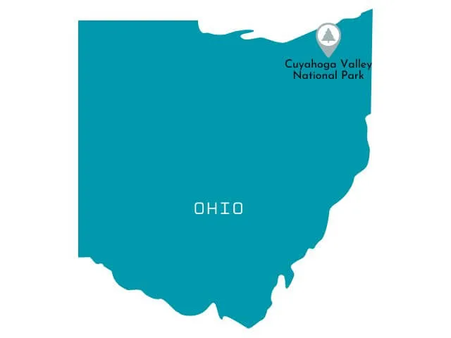
Cuyahoga Valley National Park

 Year Established: 2000
Annual Visitors: 2.2 million
Best Time to Visit: April to May, September-October
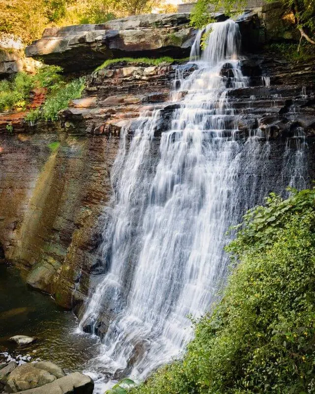
Cuyahoga Valley National Park Highlights: Hike Brandywine Falls, Hike The Ledges Trail, Take the Cuyahoga Valley Scenic Railroad, visit Deer Lick Cave and Bridal Veil Falls.
Cuyahoga Valley National Park, located in northeastern Ohio, is a unique blend of natural beauty and cultural history. The park features a variety of landscapes, including forests, rolling hills, and the winding Cuyahoga River.
One of the highlights of the park is the Ohio & Erie Canal Towpath Trail, a scenic hike or bike ride along the historic canal. Visitors can also take a ride on the Cuyahoga Valley Scenic Railroad, which travels through the park and offers views of the surrounding landscape.
The best time to visit Cuyahoga Valley National Park is during the spring and fall when the weather is mild and the foliage is at its peak. In the spring, wildflowers are in bloom and the park is alive with the sounds of migratory birds. Fall is a popular time to visit as well, as the trees turn brilliant shades of red, orange, and yellow. Summer can be hot and crowded, while winter can be cold and snowy, but it can also offer a peaceful and quiet experience for those who enjoy winter sports.
+7 National Park Service Units in Ohio
- Charles Young Buffalo Soldiers National Monument
- Dayton Aviation Heritage National Historical Park
- First Ladies National Historic Site
- Hopewell Culture National Historical Park
- James A. Garfield National Historic Site
- Perry’s Victory and International Peace Memorial
- William Howard Taft National Historic Site
Oregon National Parks
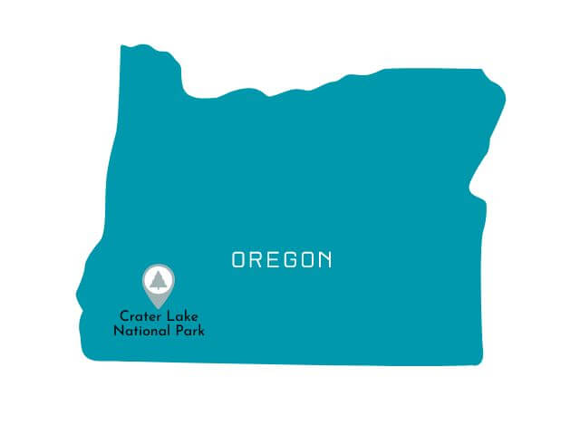

Crater Lake National Park
 Year Established: 1902
Annual Visitors: 705,000
Best Time to Visit: July to September
Crater Lake National Park Highlights:Drive Rim Drive, Hike Mount Scott, Hike Watchman Peak
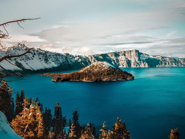
Crater Lake National Park is located in southern Oregon and is known for its deep blue water and stunning views.
The park is home to Crater Lake, which was formed by the collapse of an ancient volcano called Mount Mazama. The lake is the deepest in the United States and one of the clearest in the world. Visitors can take a boat tour of the lake to get a closer look at the many islands and cliffs that surround it.
The park also offers a variety of hiking trails, including the popular Cleetwood Cove Trail, which leads to the lake’s shore. In the winter, the park offers cross-country skiing and snowshoeing opportunities.
The best time to visit Crater Lake National Park is during the summer months when the weather is warm and the snow has melted, allowing for the best visibility of the lake and access to park amenities. However, the park can be enjoyed year-round and offers a unique experience in each season.
+3 National Park Units in Oregon
- John Day Fossil Beds National Monument
- Lewis and Clark National Historical Park
- Oregon Caves National Monument and Preserve
South Carolina National Parks

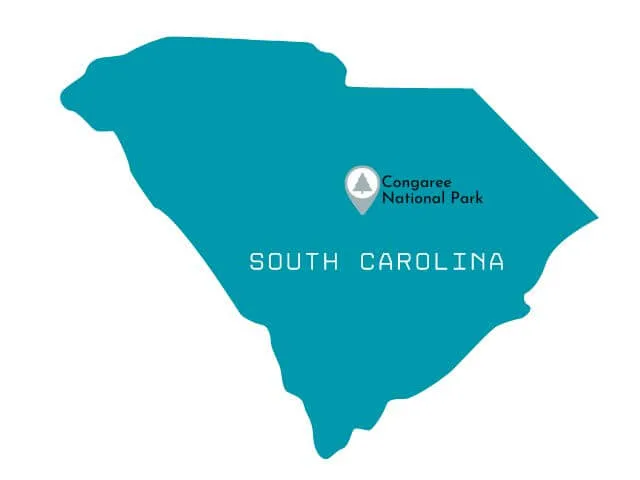
Congaree National Park

 Year Established: 2003
Annual Visitors: 160,000
Best Time to Visit: March-June, October-November
Congaree National Park Highlights: Hike the Boardwalk Loop Trail, canoeing/kayak on Cedar Creek, hike to the General Greene Tree.
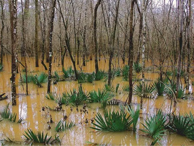
Congaree National Park is located in South Carolina and is known for its diverse and beautiful forest landscape. The park is home to a variety of wildlife, including white-tailed deer, beavers, and over 200 species of birds.
The highlight of Congaree National Park is the Congaree River, which runs through the park and provides visitors with opportunities for kayaking and fishing. The park also offers hiking trails, including the 2.4-mile Boardwalk Loop, which takes visitors through the heart of the park’s old-growth bottomland hardwood forest.
The best time to visit Congaree National Park is during the spring and fall seasons. In the spring, visitors can witness the park’s wildflowers blooming and the trees beginning to leaf out. The fall season offers a beautiful display of fall colors and the opportunity to see migratory birds.
Summertime can be hot and humid and the park can be mosquito-heavy, while the park’s boardwalk trails can be closed during the winter months due to flooding. Overall, the park is open all year round, but the best time to visit is during the shoulder seasons, when the weather is mild and the crowds are smaller.
6+ National Park Service Units in South Carolina
- Charles Pinckney National Historic Site
- Cowpens National Battlefield
- Fort Sumter and Fort Moultrie National Historical Park
- Kings Mountain National Military Park
- Ninety Six National Historic Site
- Reconstruction Era National Historical Park
South Dakota National Parks
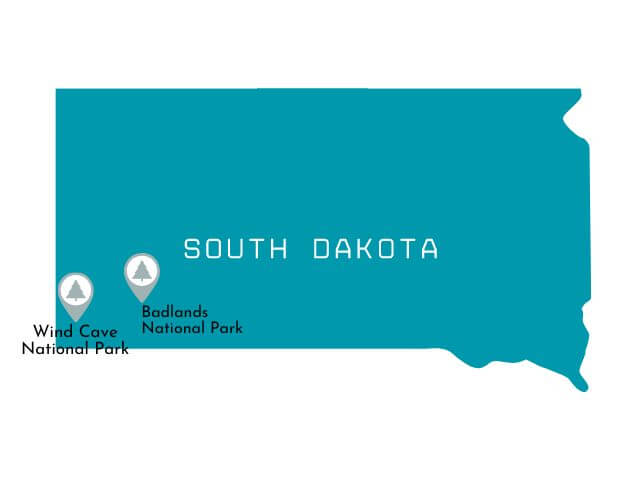
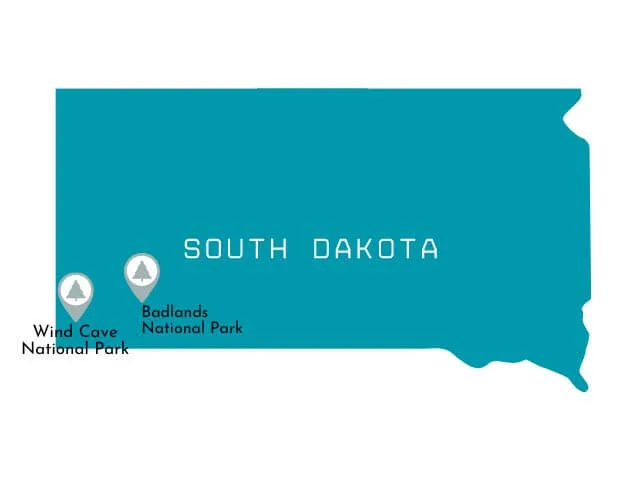
Badlands National Park

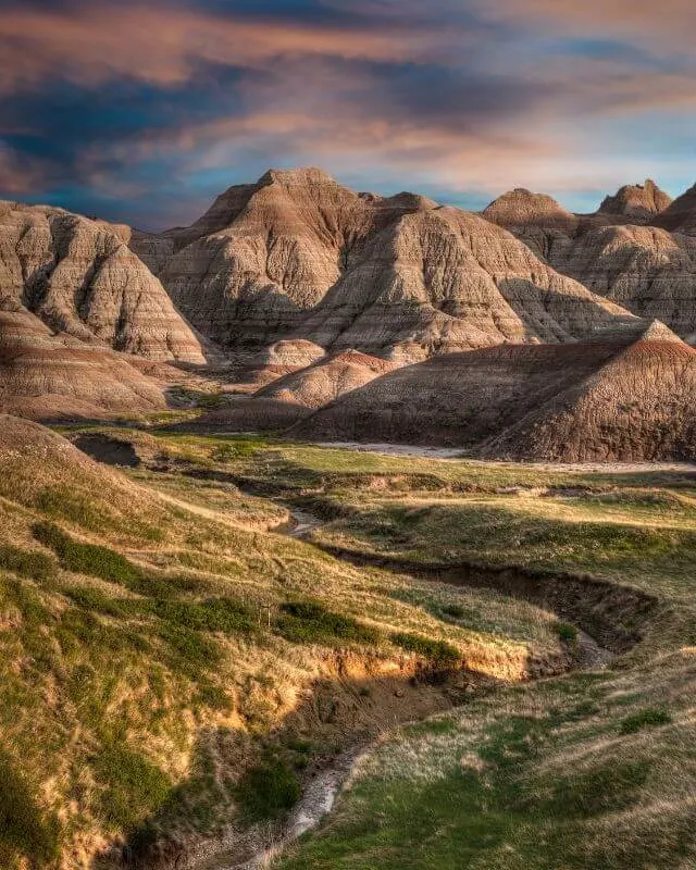 Year Established: 1978
Annual Visitors: 970,000
Best Time to Visit: April to May, September to October
Badlands National Park Highlights: Hike Notch Trail, Hike Saddle Pass Trail, Drive Badlands Loop Road & Sage Creek Rim Road.
Badlands National Park is located in South Dakota, and is known for its unique geological formations and diverse wildlife.
The park’s history is rooted in the Lakota Sioux tribe, who used the area for hunting and spiritual practices. The park was officially established in 1978 and covers 244,000 acres of land.
The park’s highlights include the Badlands Loop Road, which offers scenic views of the park’s colorful rock formations, as well as the Pinnacles Overlook, which provides a panoramic view of the park. The park is also home to a variety of wildlife, including bison, bighorn sheep, and pronghorn.
The best time to visit is during the spring and fall months, when the weather is mild and the crowds are fewer. During these months, the park’s wildflowers and wildlife are also at their peak.
Wind Cave National Park

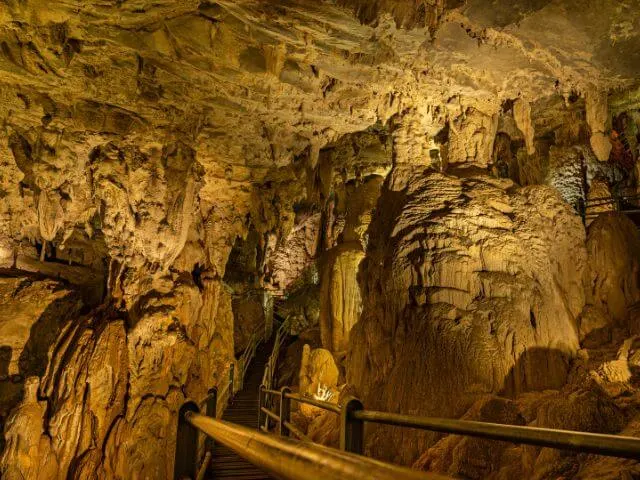 Year Established: 1903
Annual Visitors: 615,000
Best Time to Visit: March to September
Wind Cave National Park Highlights: Tour Wind Cave, Hike Rankin Ridge
Wind Cave National Park is located in the Black Hills of South Dakota and is home to one of the longest and most complex caves systems in the world. The cave is known for its unique formations, including boxwork, a rare honeycomb-like pattern found in only a few other caves worldwide. Visitors can take guided cave tours to explore the underground tunnels and learn about the geology and history of the cave.
The park also offers a variety of outdoor activities, including hiking, camping, and wildlife viewing. Visitors can explore the park’s diverse ecosystems, from the mixed-grass prairie to the ponderosa pine forests.
The best time to visit Wind Cave National Park is during the late spring and summer when the weather is mild and the cave tours are in full operation. Fall is also a great time to visit, as the changing colors of the trees make for a beautiful landscape.
+4 National Park Service Units in South Dakota
- Jewel Cave National Monument
- Minuteman Missile National Historic Site
- Missouri National Recreational River
- Mount Rushmore National Memorial
Tennessee National Parks


Great Smoky Mountains National Park

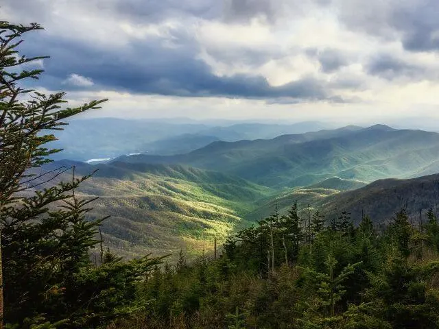 Note: Part of the Great Smoky Mountains crosses into North Carolina.
Year Established: 1934
Annual Visitors: 12.5 million
Best Time to Visit: June to November
Great Smoky Mountains National Park Highlights: See Cades Cove, Hike Clingmans Dome and Newfound Gap, Hike Alum Cave Trail.
Great Smoky Mountains National Park is located in the southern Appalachian Mountains and is the most visited national park in the United States. The park is home to an incredible diversity of plant and animal life, as well as historic structures and sites.
Visitors can hike to scenic overlooks, go fishing or horseback riding, and explore the many historic buildings and structures that are scattered throughout the park.
The best time to visit Great Smoky Mountains National Park is during the spring and fall when the weather is mild and the colors of the changing leaves are at their peak. The park is also a popular destination in the summer months when the wildflowers are in bloom and the days are long and warm. However, visitors should be prepared for crowds and busy roads during the summer.
+6 National Park Service Units in Tennessee
- Andrew Johnson National Historic Site
- Big South Fork National River and Recreation Area
- Fort Donelson National Battlefield
- Obed Wild and Scenic River
- Shiloh National Military Park
- Stones River National Battlefield
Texas National Parks

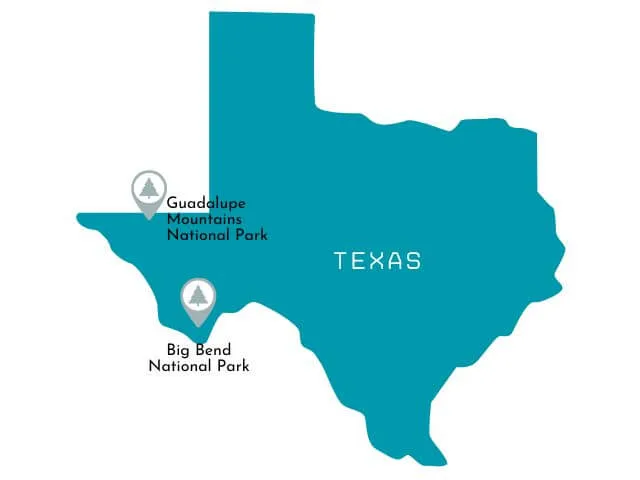
Big Bend National Park

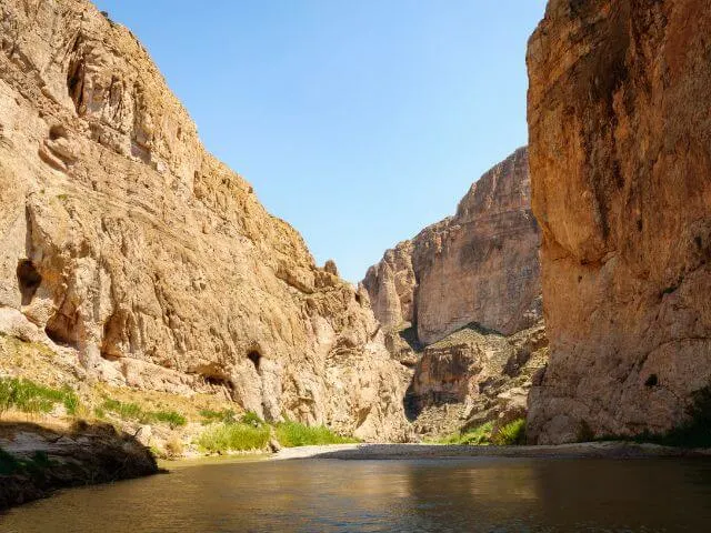 Year Established: 1944
Annual Visitors: 460,000
Best Time to Visit: November to April
Big Bend National Park Highlights: Float the Rio Grande, Hike the Lost Mine, See The Window at sunset, Hike Santa Elena Canyon, visit Boquillas del Carmen, go star gazing, drive the Maxwell Scenic Drive
Big Bend National Park is located in the Chihuahuan Desert of West Texas and covers over 800,000 acres of rugged terrain. The park is named for the bend in the Rio Grande River, which forms the border between the United States and Mexico.
The park’s history dates back over 10,000 years and is home to a diverse array of plant and animal life, including the endangered Big Bend Ranch ground squirrel. The park is also home to several historic sites, including the remains of an old cattle ranch and a military fort from the 1800s.
The park offers a wide range of outdoor activities for visitors including hiking, camping, and backpacking. The park’s highlight is the Chisos Mountains, which offer spectacular views and challenging hikes. The park also offers guided tours of the park’s caverns, including the famous Marufo Vega Trail and the Hot Springs Trail.
The best time to visit Big Bend National Park is from November to April, when temperatures are mild and the park’s wildflowers and cacti are in bloom. The park’s remote location and lack of light pollution also make it a great spot for stargazing.
Guadalupe Mountains National Park

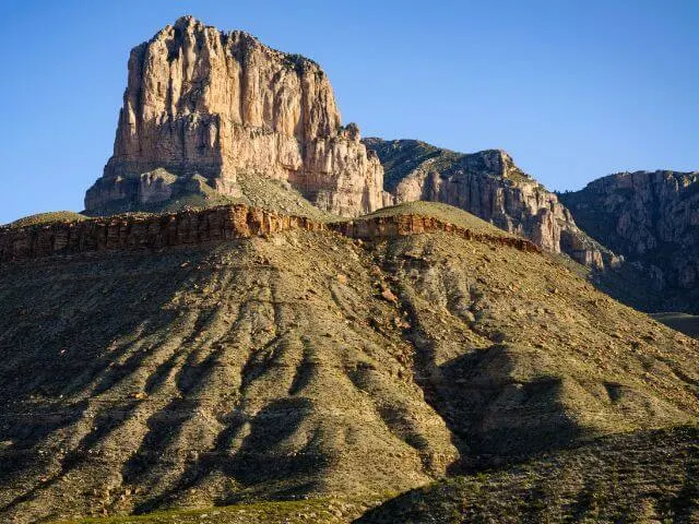 Year Established: 1966
Annual Visitors: 190,000
Best Time to Visit: March to May, September to November
Guadalupe Mountains National Park Highlights: Summit Guadalupe Peak, Visit the Salt Basin Dunes, Hike The Bowl or McKittrick Canyon, visit Dog Canyon and See Gypsum Dunes at sunset
Guadalupe Mountains National Park is a beautiful park located in West Texas, near the border of New Mexico.
The park is home to the Guadalupe Mountains, which are some of the highest peaks in Texas. The park’s main highlight is the Guadalupe Peak, which stands at 8,751 feet and is the highest point in Texas.
The park also features a variety of other outdoor activities such as hiking, backpacking, and rock climbing. There are over 80 miles of trails in the park, including the challenging Guadalupe Peak Trail and the scenic McKittrick Canyon Trail.
The best time to visit Guadalupe Mountains National Park is from September to November and from March to May. The weather during these months is mild and comfortable, making it perfect for outdoor activities.
However, visitors should be aware that the park can be quite hot during the summer months, so it’s best to avoid visiting during that time. During the fall, the park’s mountains and canyons are painted in beautiful autumn colors, making it a great time to visit for photography and nature enthusiasts.
+12 National Park Units in Texas
- Alibates Flint Quarries National Monument
- Amistad National Recreation Area
- Big Thicket National Preserve
- Chamizal National Memorial
- Fort Davis National Historic Site
- Lake Meredith National Recreation Area
- Lyndon B. Johnson National Historical Park
- Padre Island National Seashore
- Palo Alto Battlefield National Historical Park
- Rio Grande Wild and Scenic River
- San Antonio Missions National Historical Park
- Waco Mammoth National Monument
Utah National Parks

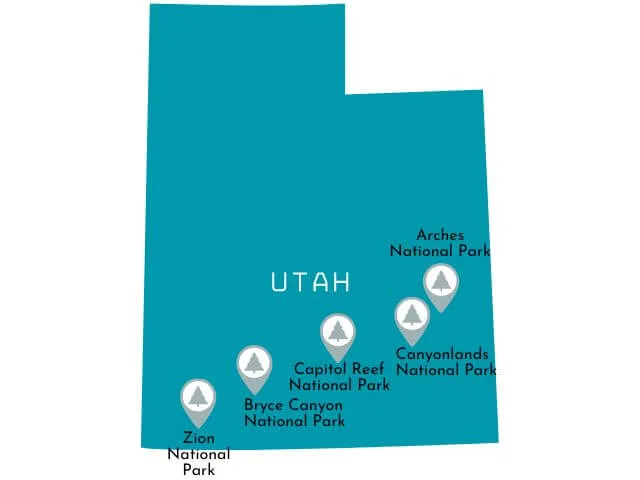
Arches National Park

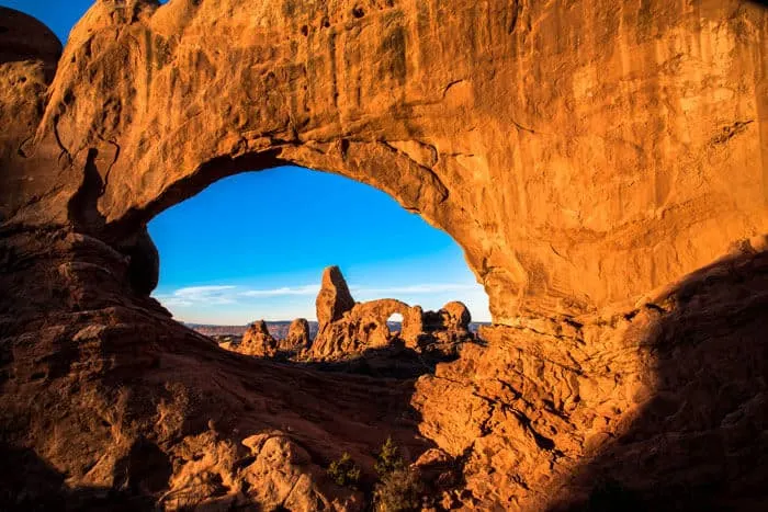 Year Established: 1971
Annual Visitors: 1.7 million
Best Time to Visit: March to May, September to November
Arches National Park Highlights: Hike Delicate Arch for sunset, visit the Double Arch, see Balanced Rock and the Fiery Furnace & Hike Windows Loop (Read all about the best Hikes in Arches NP here!)
Arches National Park is located in northeastern Utah, and is known for its over 2,000 natural sandstone arches that are spread throughout the park. The park’s red rock formations, canyons, and arches offer visitors a glimpse into the natural beauty of the American Southwest.
The park’s most famous arch, Delicate Arch, is a must-see. The arch is visible from a viewpoint accessible by a moderate 3-mile round-trip hike. The Park Avenue area, which features a 2-mile round-trip hike, is also a popular spot, offering visitors a chance to see towering red rock fins and other unique rock formations.
The best time to visit Arches National Park is during the spring and fall, when temperatures are mild and the park is less crowded. During the summer, the park can get very hot, and the park’s trails can be quite strenuous in the heat.
In the winter, the park is open but some of the roads and trails may be closed due to snow and ice. Overall, the park is open year-round, but the best time to visit is during the spring and fall.
Bryce Canyon National Park
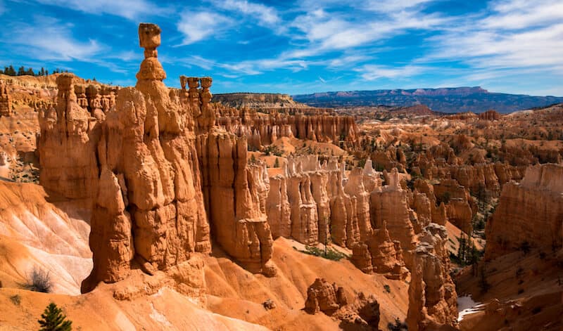
 Year Established: 1928
Annual Visitors: 2.6 million
Best Time to Visit: April to October
Bryce Canyon National Park Highlights: See sunrise along the Rim Trail, Drive the Scenic Drive and stop at all the viewpoints (Sunrise Point, Sunset Point, Bryce Point and Inspiration Point etc), Hike Navajo and Queen’s Garden Loop.
Bryce Canyon National Park is located in southern Utah and is known for its unique and vibrant orange and red rock formations called hoodoos.
The park’s main feature is the Bryce Amphitheater, a natural amphitheater created by erosion that contains thousands of hoodoos. Visitors can hike along the rim of the amphitheater to get a panoramic view of the hoodoos and the surrounding landscape, or hike down into the amphitheater for a closer look.
Other popular activities include horseback riding, stargazing, and camping.
The best time to visit Bryce Canyon National Park is from April to October when the weather is mild and the park’s facilities and road are open. During the summer months, the park offers ranger-led tours and campfire programs.
The park also offers a shuttle service to take visitors to the different viewpoints and trailheads during the peak season to reduce traffic and parking congestion. Spring and fall are also ideal for visiting the park as the weather is milder and the crowds are smaller.
Canyonlands National Park
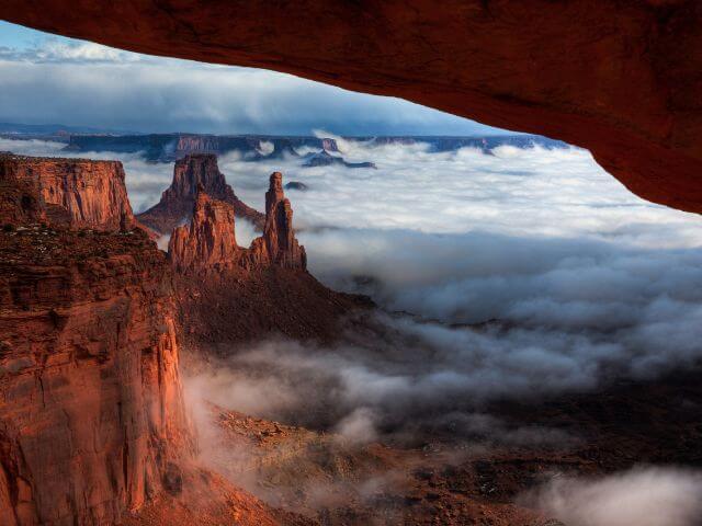
 Year Established: 1964
Annual Visitors: 735,000
Best Time to Visit: March to May, September to November
Canyonlands National Park Highlights Hike Mesa Arch for sunrise, Hike Grand Viewpoint Overlook and the Needles, See Green River Overlook and Shafer Point Overlook, explore The Maze
Canyonlands National Park is a natural wonder located in southern Utah.
The park is known for its stunning canyons, mesas, and unique rock formations. One of the highlights of the park is the Island in the Sky, a large mesa that offers panoramic views of the surrounding canyons and the Colorado River. Visitors can also explore the Needles district, where they can find towering spires, and the Maze district, which is known for its challenging backcountry hiking.
The best time to visit Canyonlands National Park is during the fall or spring, when the weather is mild and the crowds are smaller. The park can get very hot during the summer, so it is best to plan your visit during the cooler months. The park also offers many great hiking trails, so make sure to wear appropriate footwear and bring plenty of water.
Capitol Reef National Park
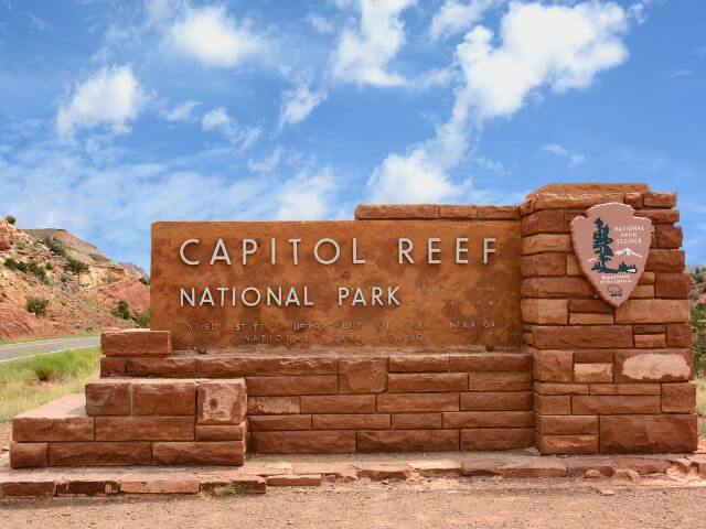
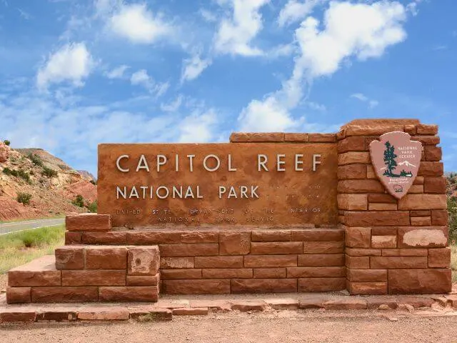 Year Established: 1971
Annual Visitors: 1.2 million
Best Time to Visit: March to May, September to November
Capitol Reef National Park Highlights: Hike Cohab Canyon and Cassidy Arch, Drive Capitol Gorge Road & The Scenic Drive
Capitol Reef National Park is located in south-central Utah and was established as a national park in 1971.
The park is known for its colorful sandstone cliffs and rugged landscape, as well as its historic orchards and pioneer settlements. The park’s main feature is the Waterpocket Fold, a 100-mile long wrinkle in the Earth’s crust that has created a unique landscape of cliffs, canyons, and domes.
The park offers a variety of activities for visitors including hiking, backpacking, and rock climbing.
The park’s scenic drive, the Capitol Reef Scenic Drive, offers visitors a chance to see the park’s main features, and the park has many hiking trails for visitors to explore.
The best time to visit Capitol Reef National Park is during the spring and fall when temperatures are mild and the crowds are smaller. Summer can be quite hot and the park can be quite crowded during the peak tourist season.
Zion National Park
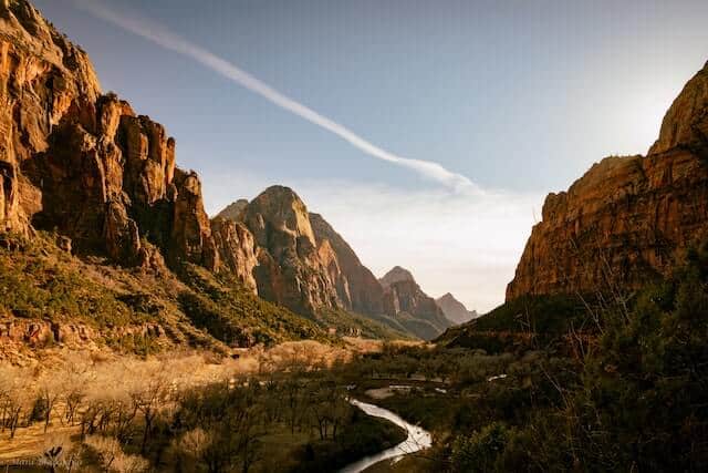
 Year Established: 1919
Annual Visitors: 4.5 million
Best Time to Visit: April to October
Zion National Park Highlights Hike The Narrows, Hike Angels Landing, Visit the Emerald Pools and Weeping Rock, Drive Zion Canyon Scenic Drive.
Zion National Park is located in the southwestern United States in the state of Utah. The park is known for its spectacular sandstone cliffs and canyons, which have been carved over millions of years by the Virgin River and its tributaries.
The park’s history dates back to the early 20th century, when it was established as Mukuntuweap National Monument in 1909. The park was later renamed Zion National Park in 1919 and has since been a popular destination for hikers, campers, and nature enthusiasts.
One of the park’s main highlights is the Narrows, a 16-mile hike through a narrow canyon with towering walls on either side. Other popular activities include hiking the Angels Landing trail, which offers breathtaking views of the valley below, and exploring the Kolob Canyons section of the park, which features red rock cliffs and unique rock formations. For more, read our guide to the Best Things to do in Zion (perfect for 1st timers!)
The best time to visit Zion National Park is during the spring and fall, when the weather is mild and the crowds are less. During the summer, temperatures can reach over 100 degrees Fahrenheit, and the park can get crowded. In the winter, some of the park’s trails may be closed due to snow and ice.
+5 National Park Units in Utah
- Cedar Breaks National Monument
- Golden Spike National Historical Park
- Natural Bridges National Monument
- Rainbow Bridge National Monument
- Timpanogos Cave National Monument
Virgin Islands National Parks

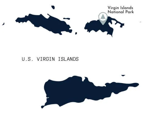
Virgin Islands National Park
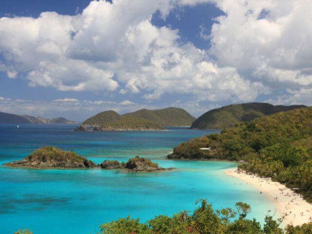
 Year Established: 1956
Annual Visitors: 130,000
Best Time to Visit: December to April
Virgin Islands National Park Highlights: Snorkel the Underwater trail in Trunk Bay, Snorkel Waterlemon Cay, Visit Maho Beach, See Cinnamon Bay
Virgin Islands National Park is located on the island of St. John in the United States Virgin Islands. The park covers over half of the island and is known for its beautiful beaches, crystal-clear waters, and diverse ecosystems. The park was established in 1956 and is a popular destination for tourists and outdoor enthusiasts.
Highlights of the park include the popular beaches of Trunk Bay and Cinnamon Bay, as well as the Reef Bay Trail, which takes hikers through lush tropical rainforests and past petroglyphs left by the island’s pre-Columbian inhabitants.
The park offers a variety of activities such as snorkeling, hiking, and bird watching and the best time to visit the park is during the winter months when the weather is dry and the crowds are smaller.
+4 Virgin Islands National Park Units
- Buck Island Reef National Monument
- Christiansted National Historic Site
- Salt River Bay National Historical Park and Ecological Preserve
- Virgin Islands Coral Reef National Monument
Virginia National Parks

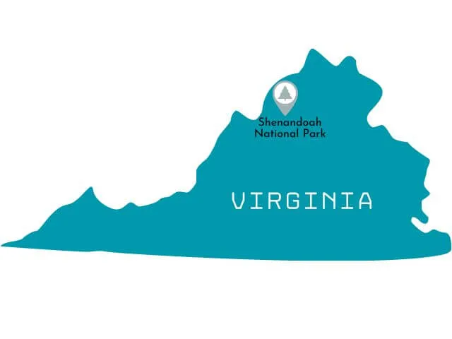
Shenandoah National Park

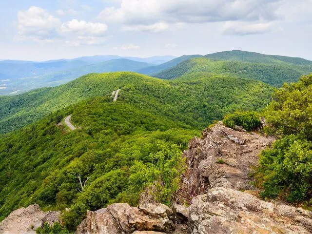 Year Established: 1935
Annual Visitors: 1.4 million
Best Time to Visit: September to November
Shenandoah National Park Highlights: Drive Skyline Drive, Hike Old Rag Trail, visit Dark Hollow Falls and walk a section of the Appalacian Trail.
Shenandoah National Park is a beautiful and historic national park located in the Blue Ridge Mountains of Virginia.
The park covers an area of around 200,000 acres and is home to a wide variety of plant and animal life, as well as many scenic vistas and hiking trails. The park’s history dates back to the early 20th century, when the federal government purchased land from private landowners in order to create the park.
One of the highlights of Shenandoah National Park is the Skyline Drive, a scenic road that runs the length of the park and offers spectacular views of the surrounding mountains and valleys. Visitors to the park can also enjoy hiking on one of the many trails that wind through the park, including the popular Old Rag Mountain and White Oak Canyon trails.
The best time to visit Shenandoah National Park is during the fall when the leaves are changing color. Spring and summer are also great time to visit due to the wildflowers and warm weather. But be prepared for crowds during these seasons.
+17 National Park Service Units in Virginia
- Appomattox Court House National Historical Park
- Arlington House, The Robert E. Lee Memorial
- Booker T. Washington National Monument
- Cedar Creek and Belle Grove National Historical Park
- Colonial National Historical Park
- Fort Monroe National Monument
- Fredericksburg and Spotsylvania County Battlefields Memorial National Military Park
- George Washington Birthplace National Monument
- George Washington Memorial Parkway
- Glen Canyon National Recreation Area
- Maggie L. Walker National Historic Site
- Manassas National Battlefield Park
- Petersburg National Battlefield
- Potomac Heritage National Scenic Trail
- Prince William Forest Park
- Richmond National Battlefield Park
- Wolf Trap National Park for the Performing Arts
Washington National Parks
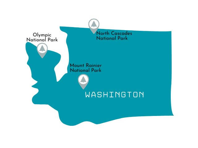

Mount Rainier National Park
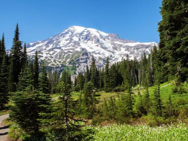
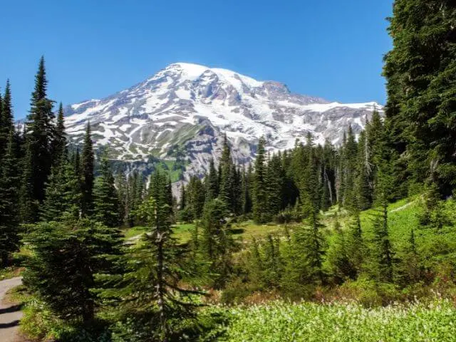 Year Established: 1899
Annual Visitors: 1.5 million
Best Time to Visit: July to September
Mount Rainier National Park Highlights: Eide the Mount Rainer Gondola to Crystal Mountain, Hike the Skyline Trail, Fremont Lookout, Tolmie Peak and Sourdough Ridge Trail.
Mount Rainier National Park is located in the state of Washington and is home to the 14,410-foot volcano, Mount Rainier. This park offers visitors a variety of recreational opportunities, including hiking, camping, and backpacking. The park’s history dates back to 1899 when it was established as the fifth national park in the United States.
The park’s highlights include the stunning views of Mount Rainier, which can be seen from many of the park’s viewpoints, as well as the park’s many hiking trails. Some popular hikes include the Skyline Trail, which offers panoramic views of the mountain and the surrounding valleys, and the Nisqually Vista Trail, which takes hikers through the park’s subalpine meadows.
The best time to visit Mount Rainier National Park is during the summer months, as the park’s snow melts and the trails become accessible. This is also the time when the park’s wildflowers are in bloom, making for a beautiful sight.
North Cascades National Park
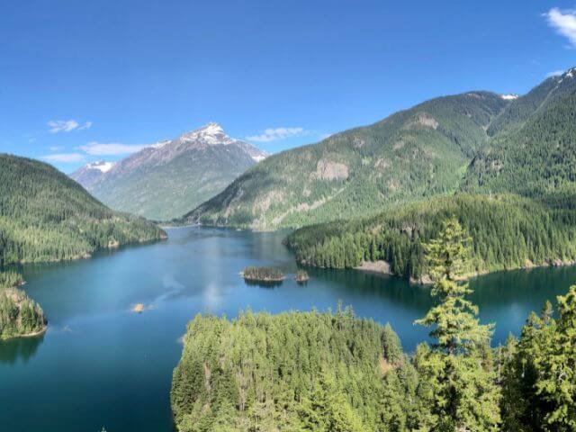
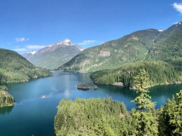 Year Established: 1968
Annual Visitors: 38,000
Best Time to Visit: June to September
North Cascades National Park Highlights: Drive North Cascades Scenic Highway, Hike Trappers Peak and Cascade Pass, enjoy the views from the Washington Pass Overlook and the Diablo Lake Vista Point.
North Cascades National Park is located in the state of Washington, USA, and is known for its rugged, glaciated peaks and stunning alpine landscapes. The park was established in 1968 and covers an area of over 500,000 acres. It is home to over 300 glaciers, including the largest glaciers in the contiguous United States. The park also features beautiful alpine meadows, old-growth forests, and over 300 miles of hiking trails.
Some of the highlights of the park include hiking to the summit of Mount Baker, the third highest mountain in Washington, visiting the picturesque Diablo Lake, and exploring the Ross Lake National Recreation Area.
The best time to visit North Cascades National Park is during the summer months of June to September when the weather is warm and the snow has melted, making it perfect for hiking and exploring the park. This is also when the park’s wildflowers are in full bloom, adding even more beauty to the already stunning landscapes.
Olympic National Park
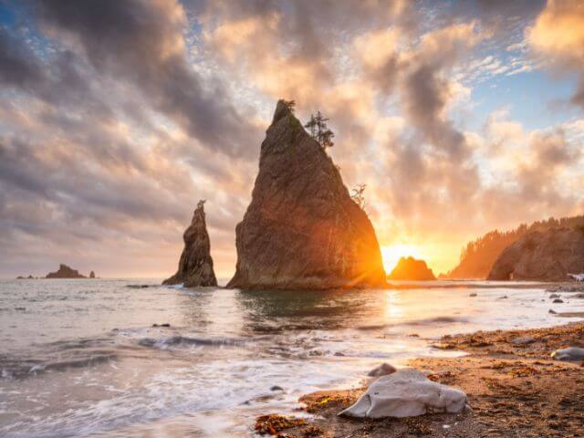
 Year Established: 1938
Annual Visitors: 3.2 million
Best Time to Visit: June to September
Olympic National Park Highlights: See Ruby Beach, Hike Hurricane Ridge, Hoh Rain Forest and Shi Shi Beach.
Olympic National Park is located in the state of Washington, USA. The park was established in 1938 and covers an area of 922,651 acres. The park is known for its unique and diverse landscapes, which include rugged coastline, ancient rainforests, and alpine meadows.
Some of the highlights of Olympic National Park include the Hoh Rainforest, which is home to some of the largest trees in the world, and the Hurricane Ridge, which offers panoramic views of the Olympic Mountains. Visitors can also take in the beauty of the park’s many waterfalls, including Sol Duc Falls and Marymere Falls. The park also offers a variety of recreational activities, including hiking, camping, and fishing.
The best time to visit Olympic National Park is during the summer months, when the weather is mild and the park’s many trails are accessible. The park can also be visited in winter, although some areas may be closed due to snow.
+7 National Park Service Units in Washington
- Ebey’s Landing National Historical Reserve
- Fort Vancouver National Historic Site
- Lake Chelan National Recreation Area
- Lake Roosevelt National Recreation Area
- Ross Lake National Recreation Area
- San Juan Island National Historical Park
- Whitman Mission National Historic Site
West Virginia National Parks
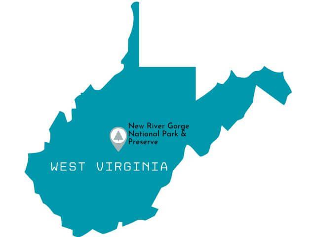

New River Gorge National Park

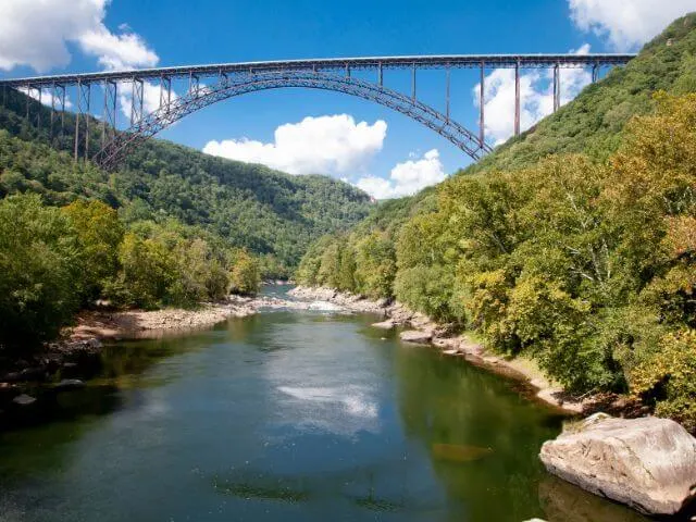 Year Established: 2020
Annual Visitors: 1.4 million
Best Time to Visit: April to October
New River Gorge National Park Highlights: Whitewater rafting, Rock climbing, The Bidgewalk, Hike Endless Wall Trail, Bike Arrowhead Trails, enjoy the view from Grandview Overlook.
New River Gorge National Park, is a popular destination for outdoor enthusiasts. The park is home to the New River, one of the oldest rivers in the world, as well as numerous hiking and biking trails, rock climbing routes, and scenic drives.
The park’s history is rooted in the coal mining industry, with remnants of the past still visible throughout the park.
The highlight of the park is the New River Gorge Bridge, the longest steel arch bridge in the Americas, which offers spectacular views of the gorge and river below.
The best time to visit the park is during the fall when the leaves change color, or in the spring when wildflowers are in bloom. Summer can be quite busy, and the park’s facilities can be crowded. Winter brings colder temperatures and potential snowfall, but also offers opportunities for winter sports such as cross-country skiing and snowshoeing.
+3 National Park Service Units in West Virginia
- Bluestone National Scenic River
- Gauley River National Recreation Area
- Harpers Ferry National Historical Park
Wyoming National Parks
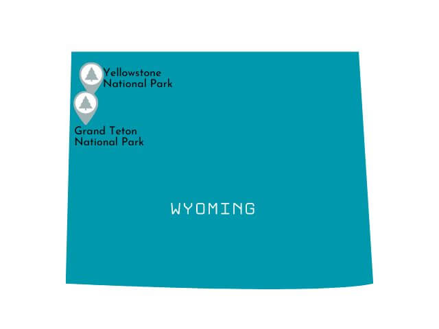
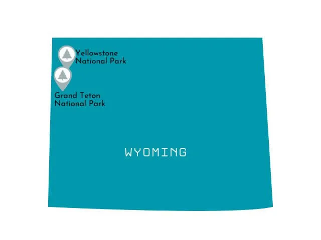
Grand Teton National Park
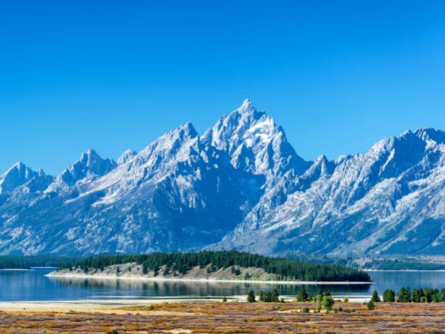
 Year Established: 1929
Annual Visitors: 3.4 million
Best Time to Visit: June to September
Grand Teton National Park Highlights: Visit Mormon Row and Schwabacher Landing, Hike Inspiration Trail and Hidden Falls, Backpack to Lake Solitude.
Grand Teton National Park is known for its stunning mountain landscapes and diverse array of outdoor activities. The park is named after Grand Teton, the highest peak in the Teton Range, which stands at 13,770 feet.
The park offers a variety of highlights for visitors to enjoy, including hiking, camping, fishing, and wildlife viewing. Visitors can take a scenic drive along the Teton Park Road to take in the views of the Teton Range, or hike to the summit of Grand Teton for a panoramic view of the surrounding mountains.
Other popular activities include fishing in Jenny Lake and exploring the park’s diverse wildlife, including bison, elk, moose, and bears.
The best time to visit Grand Teton National Park is during the summer months of June to September, when the weather is warm and the snow has melted, making it easier to access the park’s many trails.
Yellowstone National Park

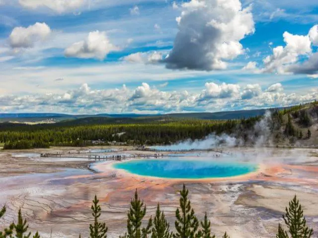 Note: Most of Yellowstone is in Wyoming, but small parts cross into Idaho and Montana.
Year Established: 1872
Annual Visitors: 4.0 million
Best Time to Visit: June to August
Yellowstone National Park Highlights: See Grand Prismatic Spring, See Old Faithful, Drive Grand Loop Road, and Hike Mount Washburn.
Yellowstone National Park is a natural wonder located in the western United States, primarily in Wyoming but also extending into Montana and Idaho. The park is known for its geothermal features, including Old Faithful geyser and the colorful Grand Prismatic Spring. It is also home to a diverse array of wildlife, including bison, elk, and grizzly bears.
RELATED: Read our Complete Guide to Yellowstone National Park
The park’s history dates back to the 1800s when it was first set aside as a public park, it is also the first national park in the world, established in 1872.
The best time to visit Yellowstone National Park is during the summer months of June through August when most of the park’s facilities and roads are open. This is also the peak season for tourism, so visitors should expect crowds.
Spring and fall are also good times to visit, as the park’s wildlife is most active during these seasons and the crowds are smaller. Winter is also a great time to visit as the park turns into a winter wonderland, but some facilities and roads may be closed due to snow.
+4 National Park System Units in Wyoming
- Devils Tower National Monument
- Fort Laramie National Historic Site
- Fossil Butte National Monument
- John D. Rockefeller, Jr. Memorial Parkway
Free Printable Checklist of National Parks Listed by State
We hope our complete guide to the 63 national parks in the USA has inspired you to visit your first park – or your 63rd! It’s so much fun to check them off your National Parks bucket list – and to help you we’ve created a free printable National Parks checklist, available as an image or PDF. This image itself is printable, but click the link if you would prefer a free PDF National Park Checklist by State.
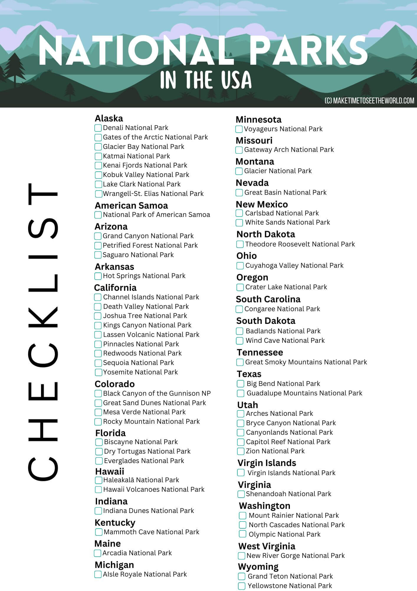
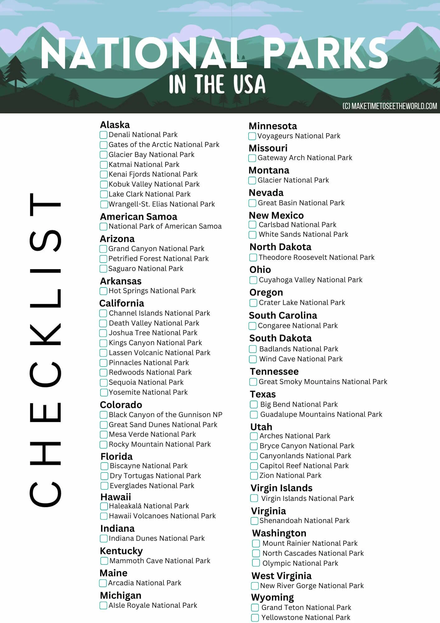
Useful US National Parks Lists (By State – Summary, In Alphabetical Order, By Most Visited, By Least Visited)
US National Parks by State (Summary)
ALASKA: Denali, Gates of the Arctic, Glacier Bay, Katmai, Kenai Fjords, Kobuk Valley, Lake Clark, and Wrangell-St. Elias
AMERICAN SAMOA: National Park of American Samoa
ARIZONA: Grand Canyon, Petrified Forest, and Saguaro
ARKANSAS: Hot Springs
CALIFORNIA: Channel Islands, Death Valley, Joshua Tree, Kings Canyon, Lassen Volcanic, Pinnacles, Redwood, Sequoia, and Yosemite
COLORADO: Black Canyon of the Gunnison, Great Sand Dunes, Mesa Verde, and Rocky Mountain
FLORIDA: Biscayne, Dry Tortugas, and Everglades
HAWAII: Haleakala and Hawai’i Volcanoes
(IDAHO: Yellowstone)
INDIANA: Indiana Dunes
KENTUCKY: Mammoth Cave
MAINE: Acadia
MICHIGAN: Isle Royale
MINNESOTA: Voyageurs
MISSOURI: Gateway Arch
MONTANA: Glacier (and Yellowstone)
NEVADA: Great Basin
NEW MEXICO: Carlsbad Caverns and White Sands
NORTH CAROLINA: Great Smoky Mountains
NORTH DAKOTA: Theodore Roosevelt
OHIO: Cuyahoga Valley
OREGON: Crater Lake
SOUTH CAROLINA: Congaree
SOUTH DAKOTA: Badlands and Wind Cave
TENNESSEE: Great Smoky Mountains
TEXAS: Big Bend and Guadalupe Mountains
UTAH: Arches, Bryce Canyon, Canyonlands, Capitol Reef, and Zion
VIRGINIA: Shenandoah
VIRGIN ISLANDS: Virgin Islands National Park
WASHINGTON: Mount Rainier, North Cascades, and Olympic
WEST VIRGINIA: New River Gorge
WYOMING: Grand Teton and Yellowstone
Complete US National Parks List (In Alphabetical Order)
1. Acadia, Maine
2. American Samoa, American Samoa
3. Arches, Utah
4. Badlands, South Dakota
5. Big Bend, Texas
6. Biscayne, Florida
7. Black Canyon of the Gunnison, Colorado
8. Bryce Canyon, Utah
9. Canyonlands, Utah
10. Capitol Reef, Utah
11. Carlsbad Caverns, New Mexico
12. Channel Islands, California
13. Congaree, South Carolina
14. Crater Lake, Oregon
15. Cuyahoga Valley, Ohio
16. Death Valley, California (+ Nevada)
17. Denali, Alaska
18. Dry Tortugas, Florida
19. Everglades, Florida
20. Gates of the Arctic, Alaska
21. Gateway Arch, Missouri (+ Illinois)
22. Glacier, Montana
23. Glacier Bay, Alaska
24. Grand Canyon, Arizona
25. Grand Teton, Wyoming
26. Great Basin, Nevada
27. Great Sand Dunes, Colorado
28. Great Smoky Mountains, Tennessee (+ North Carolina)
29. Guadalupe Mountains, Texas
30. Haleakala, Hawaii
31. Hawai’i Volcanoes, Hawaii
32. Hot Springs, Arkansas
33. Indiana Dunes, Indiana
34. Isle Royale, Michigan
35. Joshua Tree, California
36. Katmai, Alaska
37. Kenai Fjords, Alaska
38. Kings Canyon, California
39. Kobuk Valley, Alaska
40. Lake Clark, Alaska
41. Lassen Volcanic, California
42. Mammoth Cave, Kentucky
43. Mesa Verde, Colorado
44. Mount Rainier, Washington
45. New River Gorge, West Virginia
46. North Cascades, Washington
47. Olympic, Washington
48. Petrified Forest, Arizona
49. Pinnacles, California
50. Redwood, California
51. Rocky Mountain, Colorado
52. Saguaro, Arizona
53. Sequoia, California
54. Shenandoah, Virginia
55. Theodore Roosevelt, North Dakota
56. Virgin Islands, US Virgin Islands
57. Voyageurs, Minnesota
58. White Sands, New Mexico
59. Wind Cave, South Dakota
60. Wrangell-St. Elias, Alaska
61. Yellowstone, Wyoming (+ Idaho & Montana)
62. Yosemite, California
63. Zion, Utah
US National Parks List: By Top 10 Most Visited
These are the Top 10 US National Parks by visitation numbers from 2021 (2022/3 data not currently available)
- Great Smoky Mountains NP: 14.1 million
- Zion NP: 5 million
- Yellowstone NP: 4.9 million
- Grand Canyon NP: 4.5 million
- Rocky Mountain NP: 4.4 million
- Acadia NP: 4 million
- Grand Teton NP: 3.9 million
- Yosemite NP: 3.3 million
- Indiana Dunes NP: 3.2 million
- Glacier NP: 3.1 million
US National Parks List: By Least Visited
These are the 10 Least Visited US National Parks by visitation numbers from 2021 (2022 data not currently available)
- Gates of the Arctic NP: 9,457
- NP of American Samoa: 8,495
- Kobuk Valley NP: 11,540
- North Cascades NP: 17,855
- Lake Clark NP: 18,278
- Katmai NP: 24,764
- Isle Royale NP: 25,844
- Wrangell-St. Elias NP: 50,189
- Dry Tortugas NP: 83,817
- Glacier Bay NP: 89,768
With so many incredible NPs it can be a little overwhelming, but we hope our complete list of National Parks by State in the USA has helped you narrow down which ones you want to tick off your National Park Bucket List first!
We hope our US National Parks List had been a huge help in planning your adventures, and if you know of anyone else that needs a little bit of inspiration or assistance in planning their National Parks trip, please be sure to share on social media: Facebook, Flipboard, Twitter or grab an image from below for Pinterest. And remember – sharing is caring (and we thank you in advance!)
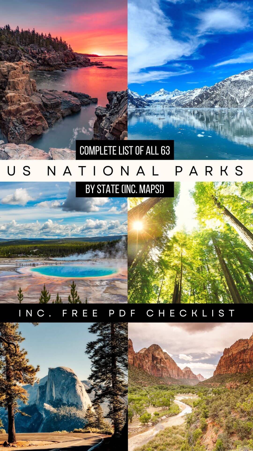

READY FOR MORE USA TRAVEL INSPIRATION? YOU MIGHT BE INTERESTED IN THESE TRAVEL TIPS, TRAVEL ARTICLES, DESTINATION GUIDES, TRAVELER RESOURCES, AND RELATED POSTS ABOUT OTHER AMAZING CITIES IN NORTH AMERICA:
- Chicago: An Awesome Weekend in Chicago – Things to do, Where to Stay & What to eat!
- Los Angeles: An Incredible Weekend Getaway in Los Angeles
- Dallas: Everything’s bigger in Texas and Dallas & Dallas Fort Worth are no exception!
- Las Vegas: Get the Best of Sin City! Things to do, where to stay and where to eat! + Where to stay in Las Vegas (whatever your budget), the TOP 40+ FREE Things to do in Las Vegas, Best Things to do in Downtown Las Vegas, Road Trips from Las Vegas, Best Things to do in Downtown Las Vegas & Las Vegas Tip to Know Before You Go
- Portland: 10 Fun Things to do in Portland Oregon + Day Trips from Portland
- Cincinnati: Things to do in Cincinnati & Day Trip Ideas
Hi There! Thanks for reading the Ultimate US National Park List Travel Guide – I just wanted to let you know that this post contains affiliate links, which means if you purchase something after clicking a link, I may get a small commission – which is at absolutely no cost to you. If you enjoyed this article and are going to be searching for some of the things I mention anyway, I would love it if you could click through from the links above & thank you in advance! Read my full Disclosure here.
And a huge Thank You for reading the MakeTimeToSeeTheWorld travel blog.